Hydrographic Survey Dubai
Marine hydrographic and bathymetric survey services in Dubai and across UAE waters. Single-beam and multi-beam sonar for seabed mapping, port surveys, and coastal projects.
Hydrographic & Bathymetric Survey Services in Dubai
Hydrographic surveys measure and map the underwater features of rivers, harbours, coastal areas, and open sea — producing bathymetric charts and seabed models used for dredging design, port development, and marine infrastructure projects.
Al Warqa Survey Engineering operates single-beam and multi-beam echo sounding systems across Dubai Creek, the Arabian Gulf coast, and UAE inland waterways. Our surveys comply with IHO S-44 standards and are delivered in formats required by Dubai Maritime City Authority (DMCA) and other UAE marine authorities.
Our Methodology
Delivering excellence through a proven three-stage workflow
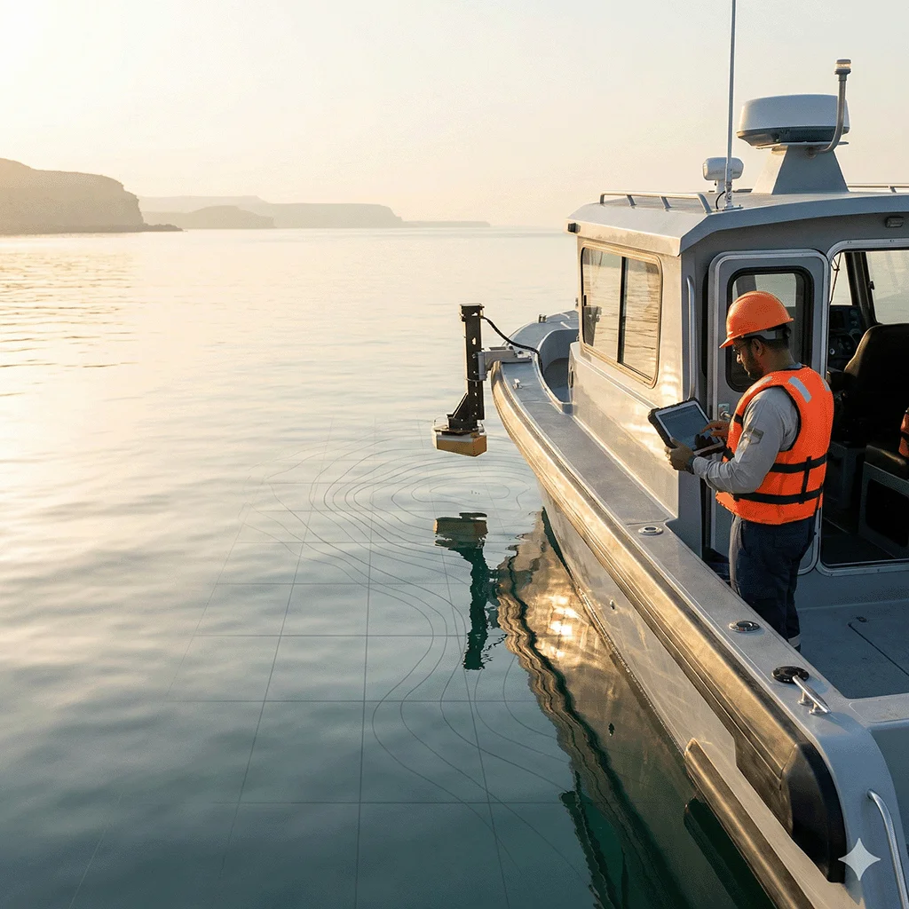
Vessel & Equipment Setup
Deploy echo sounder with GPS/GNSS positioning and motion reference unit for tide and heave correction.
Systematic Sounding Lines
Execute planned sounding lines at required spacing, capturing full coverage of the survey area.
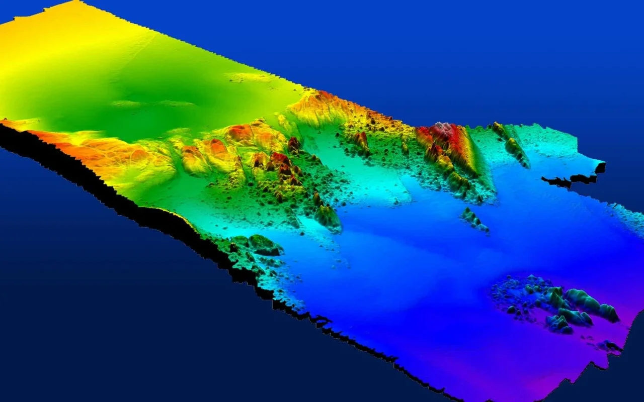
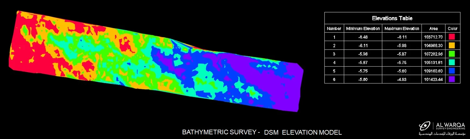
Data Processing & Chart Production
Process soundings with tidal corrections, produce bathymetric charts and seabed DTM.
Applications
Industry sectors and use cases we serve
Port & Marina Development
Seabed surveys for berth design, dredging, and navigation channel assessment
Coastal Reclamation
Pre- and post-reclamation surveys for volume calculations and compliance
Dredging Monitoring
Progress surveys to confirm design depths are achieved
Pipeline & Cable Routes
Seabed profiling for marine infrastructure routing and design
Deliverables
What you receive at the end of every project
- Bathymetric chartDWG / PDF — IHO S-44 compliant
- Digital Terrain Model — seabed surfaceTIN / Grid
- Dredging volume calculations
- Sounding data in ASCII / LAS format
- Survey report with accuracy statement
Technology Stack
Industry-leading equipment and software
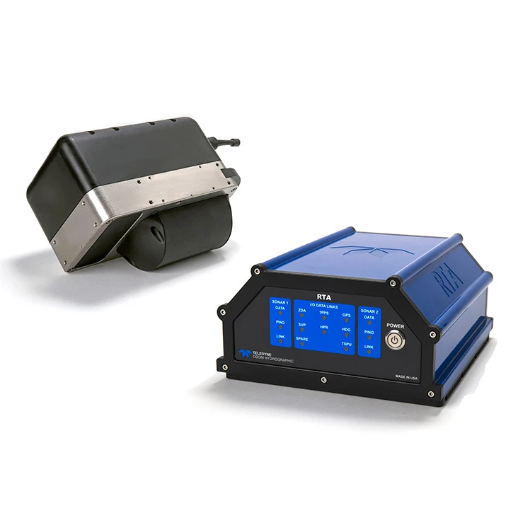
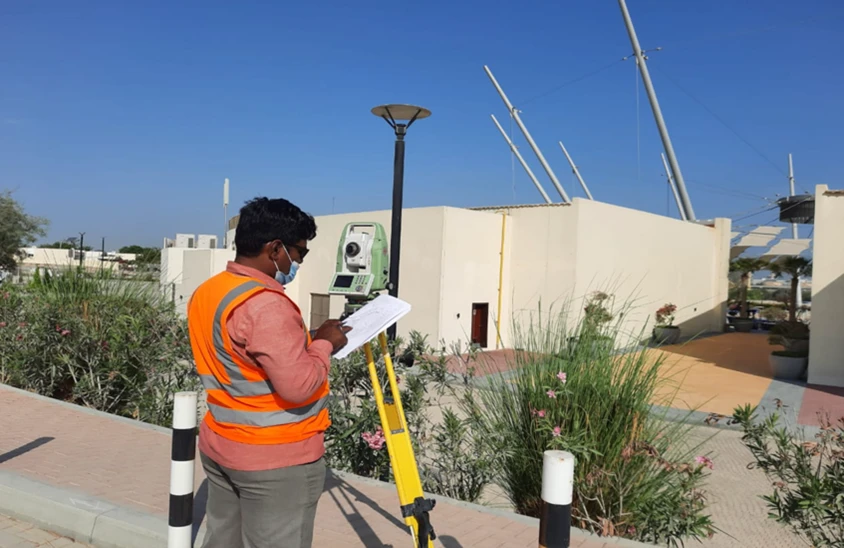
Single & Multi-Beam Echo Sounders
Advanced surveying technology for precision data capture and analysis.
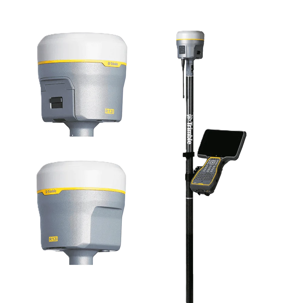
Trimble R12 GNSS
Advanced surveying technology for precision data capture and analysis.

HYPACK / EIVA NaviPac
Advanced surveying technology for precision data capture and analysis.
Frequently Asked Questions
A bathymetric survey measures and maps the depth and shape of a seabed, riverbed, or lakebed using echo-sounding sonar. The result is a bathymetric chart or 3D seabed model showing water depths across the surveyed area — used for dredging design, port development, navigation safety, and marine construction planning.
Bathymetric survey specifically measures water depths. A hydrographic survey is broader — it includes bathymetry plus seabed characterisation, tidal observations, and all data needed for safe navigation and marine design. The two terms are commonly used interchangeably in the UAE market.
We survey Dubai Creek, Palm Jumeirah lagoons, Jebel Ali Port approaches, Dubai Harbour, and open Arabian Gulf coastal areas. We also operate in Abu Dhabi, Sharjah, Ras Al Khaimah, and other UAE coastal zones.
Our surveys comply with IHO S-44 (Standards for Hydrographic Surveys) and are deliverable in formats required by DMCA, Ports, Customs and Free Zone Corporation (PCFC), and project specifications.
Have more questions?
Our team of experts is ready to assist you with your specific project requirements across the GCC.
Related Services
Explore our other professional surveying solutions
Topographical Survey Dubai
Accurate topographical surveys in Dubai capturing terrain features, ground levels, and surface detail for engineering design, planning, and development projects.
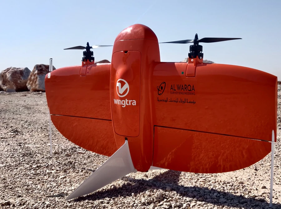
Aerial Drone Mapping
High-resolution aerial data acquisition for terrain modeling, volumetric analysis, and site documentation.
Land Survey Dubai
Professional land survey services in Dubai for construction, development, and infrastructure projects. Authority-approved, ISO-certified, 25+ years experience.
Contact us directly
Reach our team instantly via WhatsApp, phone, or email.
Also available in Riyadh