Total Station Survey Services
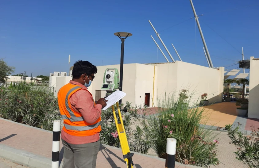
High-precision total station surveying using Leica TS16 robotic total stations for construction layout, set-out, and engineering applications across Dubai and the UAE.
Precision Total Station Surveying for Engineering Projects
Total station surveying is the backbone of engineering-grade positioning. Using robotic total stations like the Leica TS16, our team captures high-precision horizontal and vertical measurements for construction layout, set-out, monitoring, and detailed engineering surveys where sub-centimetre accuracy is non-negotiable.
Unlike GNSS-only surveys, total stations deliver reliable measurements in GNSS-denied environments — inside buildings, under canopies, in dense urban areas, and around reflective facades — making them essential for structural, MEP, and construction-phase work.
Our Methodology
Delivering excellence through a proven three-stage workflow
Control Establishment
Setup of primary and secondary control networks with GNSS tie-in for georeferencing.
Field Observations
Leica TS16 robotic total station measurements with redundancy checks and on-site quality verification.
Data Reduction & Output
Adjustment of observations, coordinate computation, and preparation of deliverables in client formats.
Applications
Industry sectors and use cases we serve
Construction Set-Out & Layout
Transfers design coordinates to site for foundations, columns, and structural grid
High-Precision Engineering Surveys
Detailed measurement of bridges, tunnels, and infrastructure components
Structural Monitoring
Deformation and settlement tracking over time with millimetre-level accuracy
Topographic Detail Surveys
Feature capture and level checks in GNSS-denied areas
Control Network Establishment
Horizontal and vertical control for large-scale construction projects
Deliverables
What you receive at the end of every project
- Set-out drawings and stakeout reports
- Coordinate lists and control reports
- Detail survey drawingsDWG / DXF
- Deformation monitoring reports
- Structural measurement reports
- Control point coordinate database
- Survey accuracy statement
Technology Stack
Industry-leading equipment and software
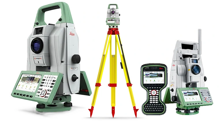
Leica TS16 Robotic Total Station
Advanced surveying technology for precision data capture and analysis.

Leica Captivate Field Software
Advanced surveying technology for precision data capture and analysis.
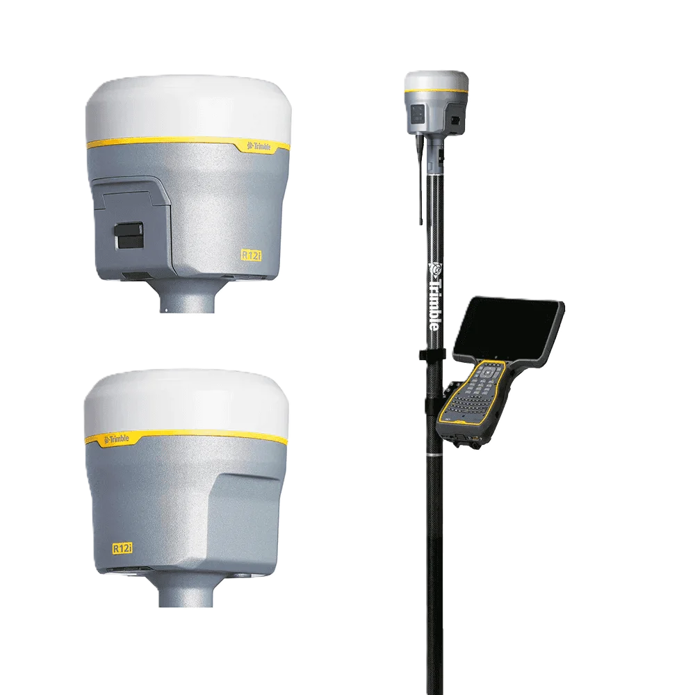
Trimble R12 GNSS
Advanced surveying technology for precision data capture and analysis.
AutoCAD
Advanced surveying technology for precision data capture and analysis.

Leica Infinity
Advanced surveying technology for precision data capture and analysis.
Frequently Asked Questions
A total station is a precision electronic instrument that measures horizontal angles, vertical angles, and distances. It is used for construction set-out, detail topographic surveys, control network establishment, and structural monitoring — anywhere sub-centimetre accuracy is needed.
A robotic total station (like the Leica TS16 we use) can be remotely operated by a single surveyor, eliminating the need for a second person at the prism. It speeds up site work and improves accuracy through auto-tracking.
Our Leica TS16 delivers ±1 arc-second angular accuracy and ±1mm + 1.5ppm distance accuracy. For typical construction layout we deliver ±5mm positional accuracy on site.
Total stations are preferred for construction layout where GNSS accuracy is insufficient, GNSS-denied environments (indoors, tunnels, urban canyons), and any work requiring millimetre-level positioning.
Have more questions?
Our team of experts is ready to assist you with your specific project requirements across the GCC.
Related Services
Explore our other professional surveying solutions
Land, Engineering & Cadastral Surveying
Precision boundary, control, and engineering surveys supporting development, construction, and regulatory approvals.
As-Built Surveys (3D Laser Scanning-Based)
High-accuracy 3D laser scanning for documentation and verification of existing building structures, including slab levels, core walls, and structural geometry.
Topographic & Terrain Mapping
High-accuracy terrain and elevation mapping for infrastructure, development, and engineering projects.
Contact us directly
Reach our team instantly via WhatsApp, phone, or email.
Also available in Riyadh