GPR Survey Services
Ground Penetrating Radar (GPR) survey services in Dubai for non-destructive detection and mapping of buried utilities, voids, rebar, and subsurface structures.
Ground Penetrating Radar Survey in Dubai & UAE
Ground Penetrating Radar (GPR) surveys use electromagnetic pulses to detect and map buried utilities, voids, rebar, and subsurface anomalies without excavation. GPR is the primary tool for pre-excavation utility mapping, concrete scanning, and void detection across construction sites in Dubai and the UAE.
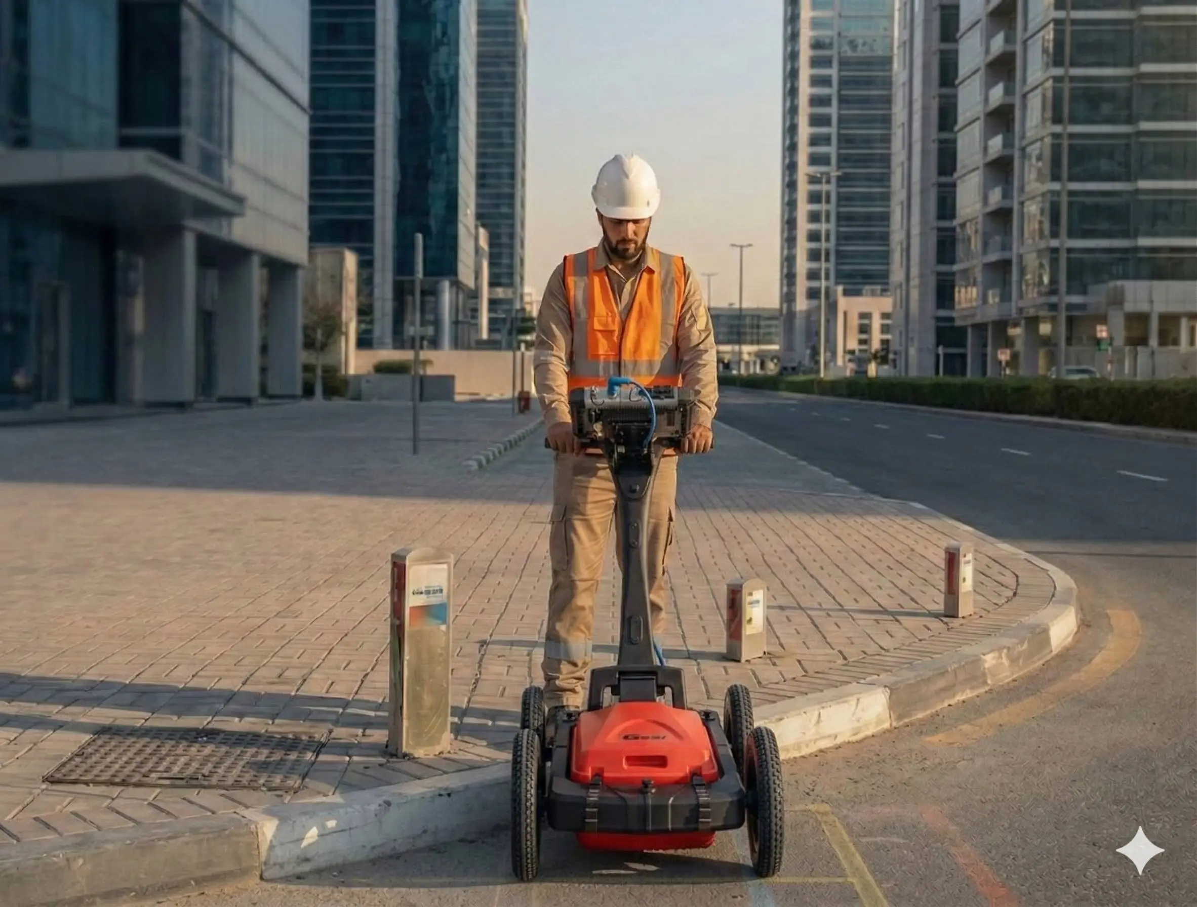
Al Warqa Survey Engineering uses GSSI GPR systems with experienced operators, delivering same-day preliminary findings and detailed reports with CAD utility drawings.
Our Methodology
Delivering excellence through a proven three-stage workflow
Site Preparation & Desktop Study
Review of available utility records and site drawings to plan GPR scan lines and grid coverage.
GPR Data Acquisition
Systematic GPR scanning across survey area using calibrated antenna frequencies suited to detection depth requirements.
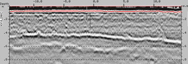
Radargram Interpretation & Mapping
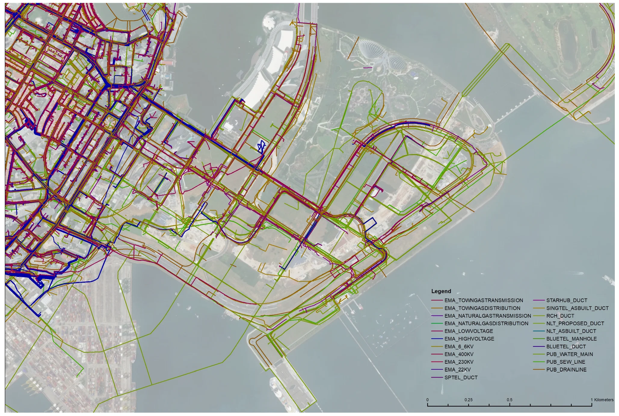
Analysis of GPR data to identify utility signatures, depths, and alignments, exported into CAD drawings and reports.
Applications
Industry sectors and use cases we serve
Pre-Excavation Utility Detection
Identifies buried pipes, cables, and ducts before breaking ground
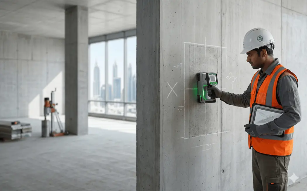
Concrete Scanning
Locates rebar, post-tension cables, and voids within slabs
Void & Sinkhole Detection
Detects subsurface voids under roads and structures
Pavement Layer Analysis
Measures road layer thickness and subbase condition
Archaeology & Environmental
Non-invasive subsurface investigation
Deliverables
What you receive at the end of every project
- Utility detection layout drawingsDWG / DXF
- GPR radargram interpretations
- Utility depth profiles
- Marked service plans with coordinates
- GPR survey report
Technology Stack
Industry-leading equipment and software
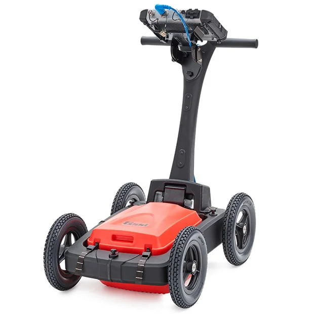
GSSI GPR System
Advanced surveying technology for precision data capture and analysis.
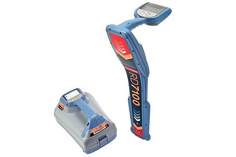
Cable & Pipe Locators
Advanced surveying technology for precision data capture and analysis.
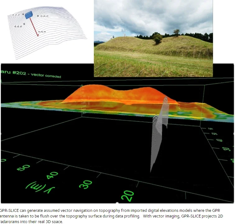
GPR Slice Software
Advanced surveying technology for precision data capture and analysis.
AutoCAD
Advanced surveying technology for precision data capture and analysis.
GPS/GNSS Positioning
Advanced surveying technology for precision data capture and analysis.
Frequently Asked Questions
In typical Dubai sandy soils, GPR detects metallic utilities to 4–5m depth. Non-metallic utilities such as plastic pipes are typically detected to 2–3m.
Yes. GPR is widely used for concrete scanning to locate rebar, post-tension cables, conduits, and voids within slabs and walls.
Yes, for urgent projects we provide preliminary field findings and utility marking on the same day. Detailed CAD drawings and reports are delivered within 2–3 business days.
Yes. GPR emits very low-power non-ionizing radiation and is completely safe for indoor use in occupied buildings.
Have more questions?
Our team of experts is ready to assist you with your specific project requirements across the GCC.
Related Services
Explore our other professional surveying solutions
Underground Utility Surveys
Detection, mapping, and verification of buried utility networks using GPR and electromagnetic locating systems.
Concrete Scanning
Non-destructive scanning of concrete elements to detect reinforcement, post-tension cables, and embedded services.
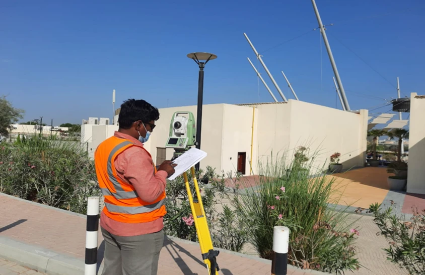
Land, Engineering & Cadastral Surveying
Precision boundary, control, and engineering surveys supporting development, construction, and regulatory approvals.
Contact us directly
Reach our team instantly via WhatsApp, phone, or email.
Also available in Riyadh