3D Laser Survey Dubai
High-accuracy 3D laser scanning services in Dubai for buildings, infrastructure, and industrial facilities. Point cloud capture to millimetre-level precision.
3D Laser Survey Services Across Dubai & UAE
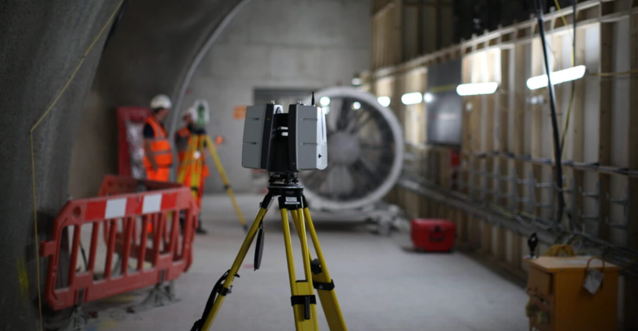
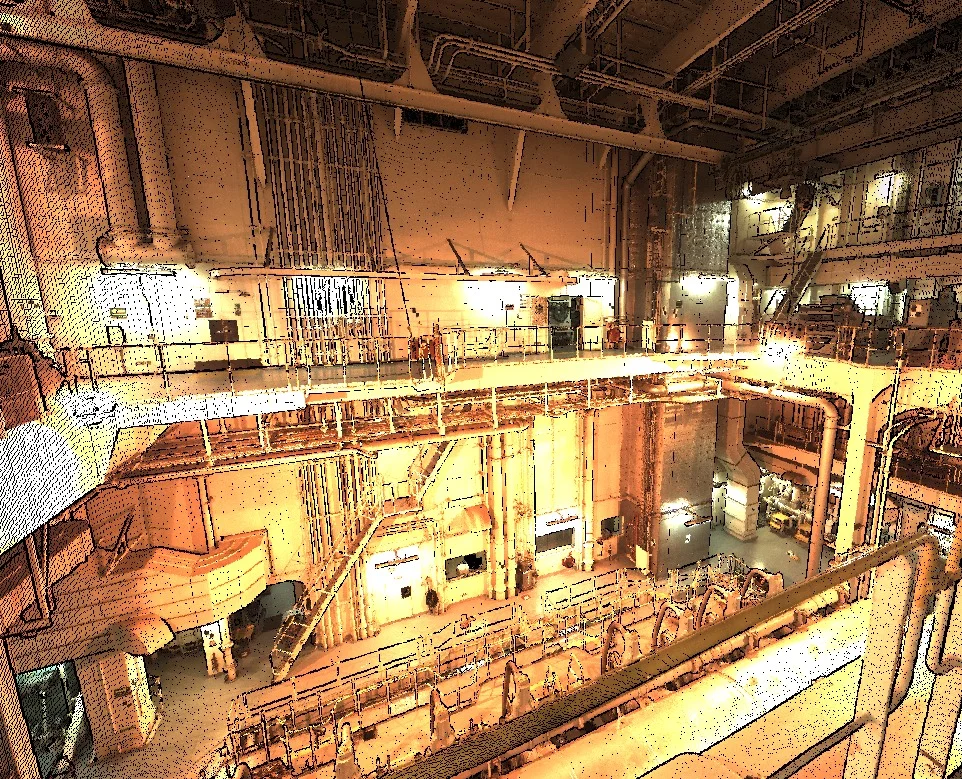
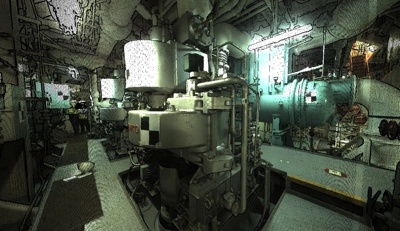
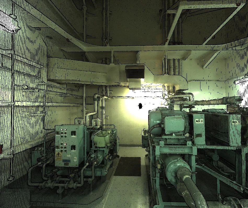
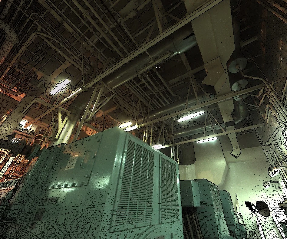
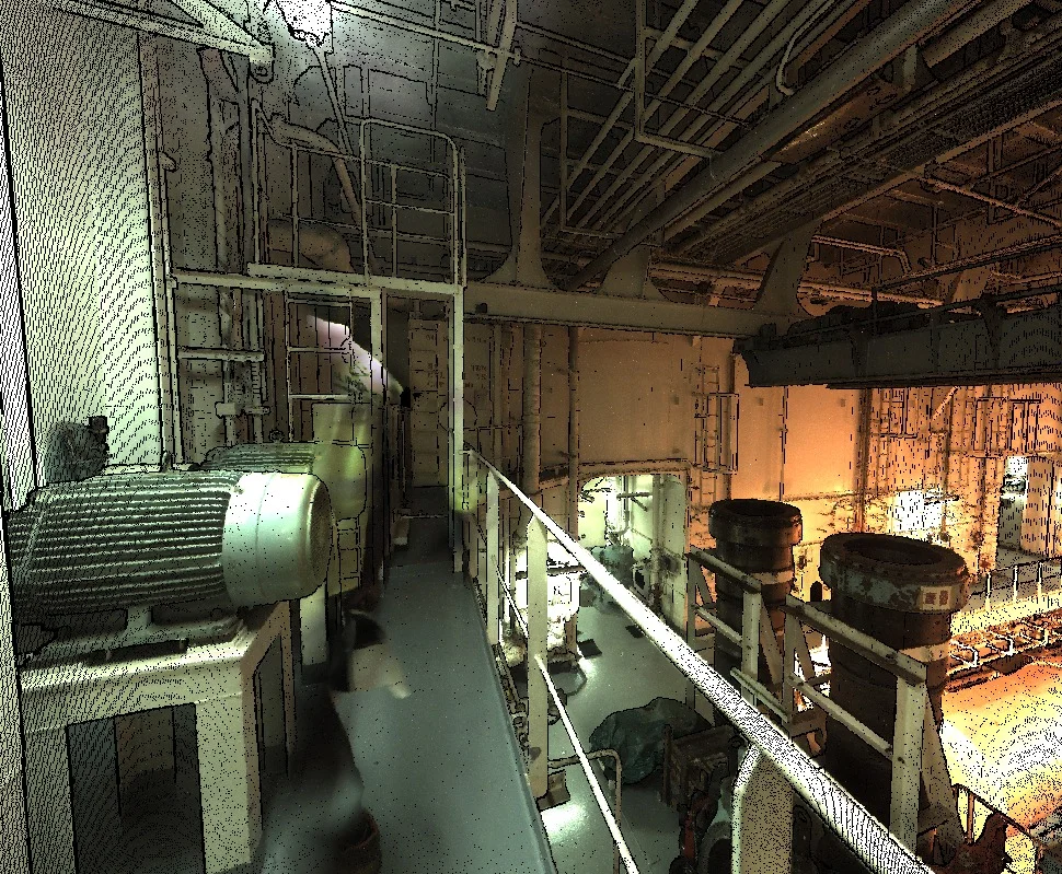
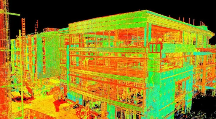
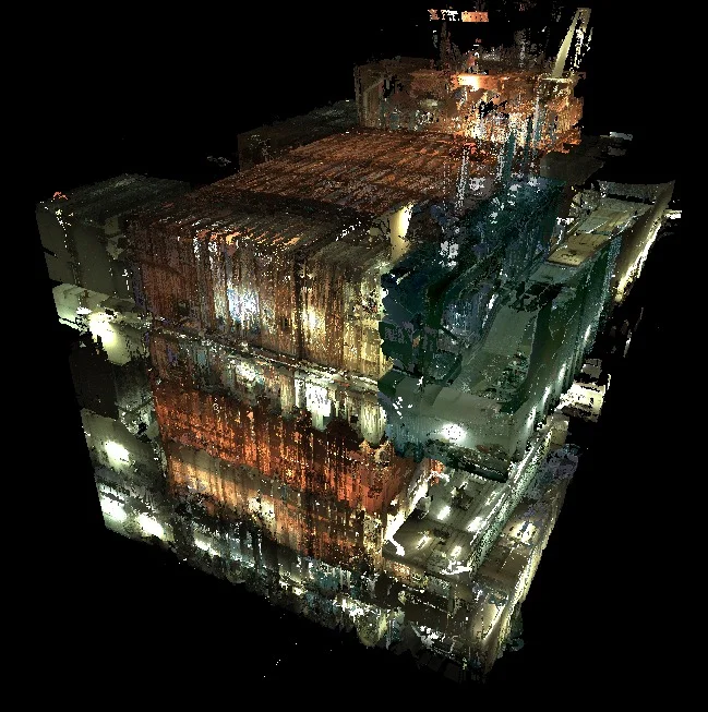
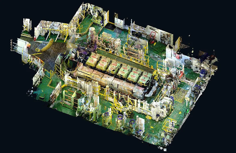
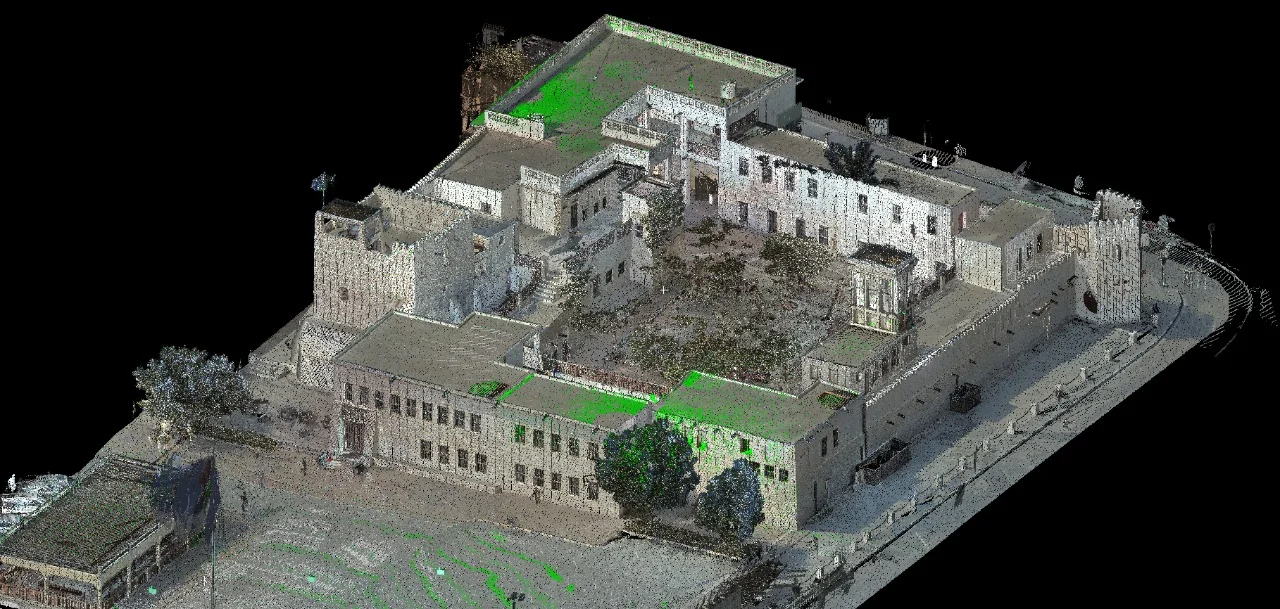
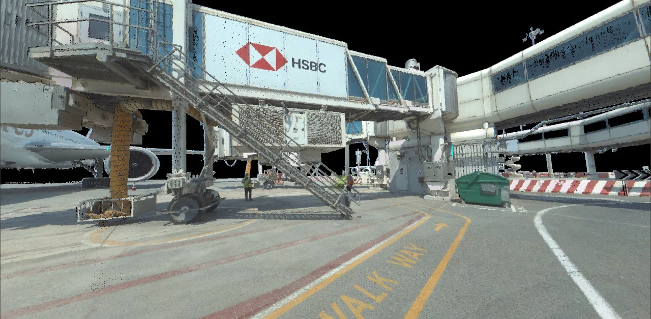
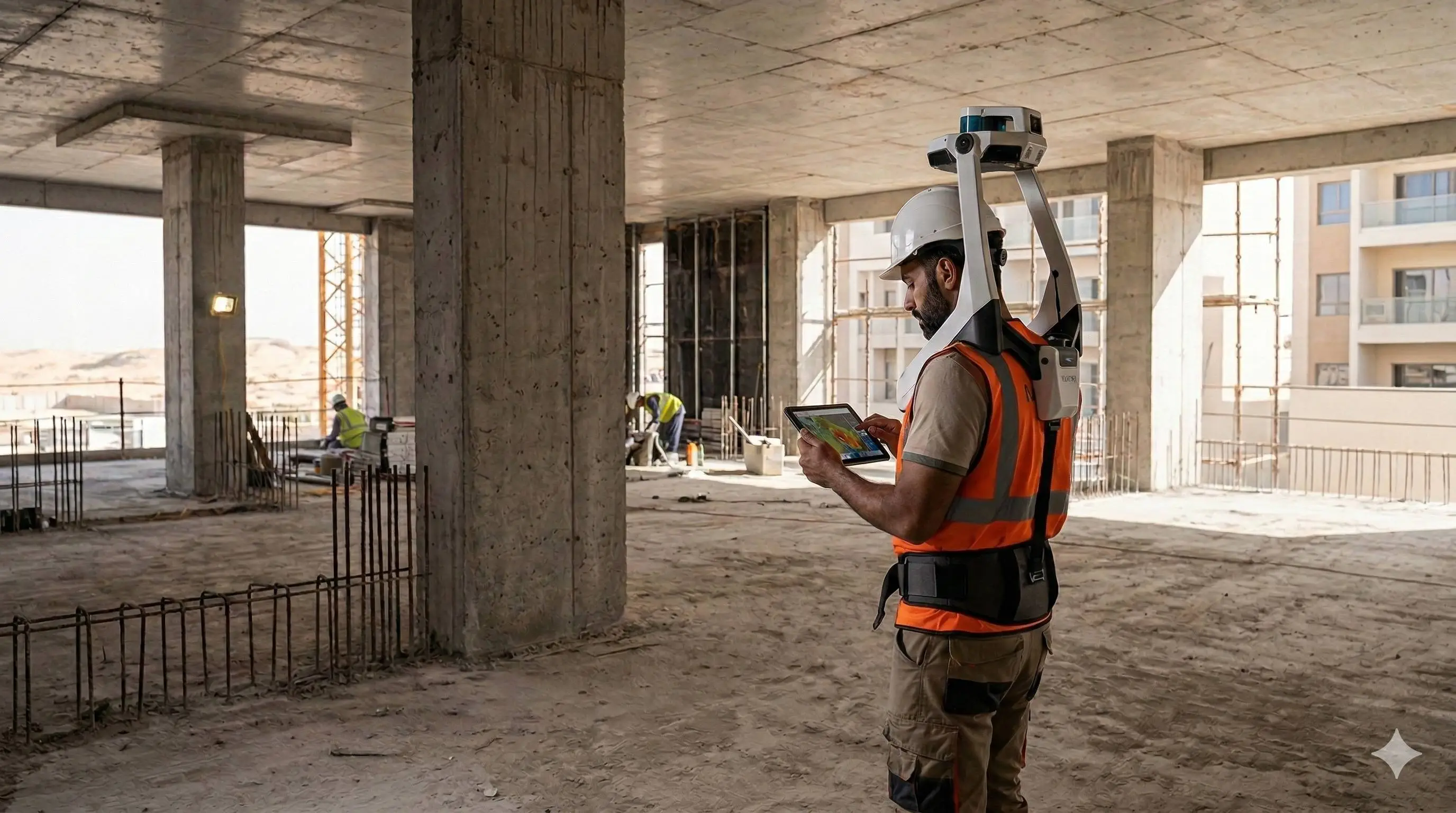
3D laser surveys in Dubai use terrestrial LiDAR technology to capture complete spatial data of buildings, structures, and industrial environments. The resulting point cloud delivers an accurate, measurable 3D model used for as-built documentation, renovation planning, BIM modelling, and deviation analysis.
Al Warqa Survey Engineering operates Leica RTC360 and Trimble X7 scanners with full survey control integration, delivering certified point clouds and drawings compliant with project and authority requirements across Dubai, Abu Dhabi, and the wider UAE.
Our Methodology
Delivering excellence through a proven three-stage workflow
Site Setup & Control Integration
Scanner deployment with survey control points for positional accuracy and georeferencing.
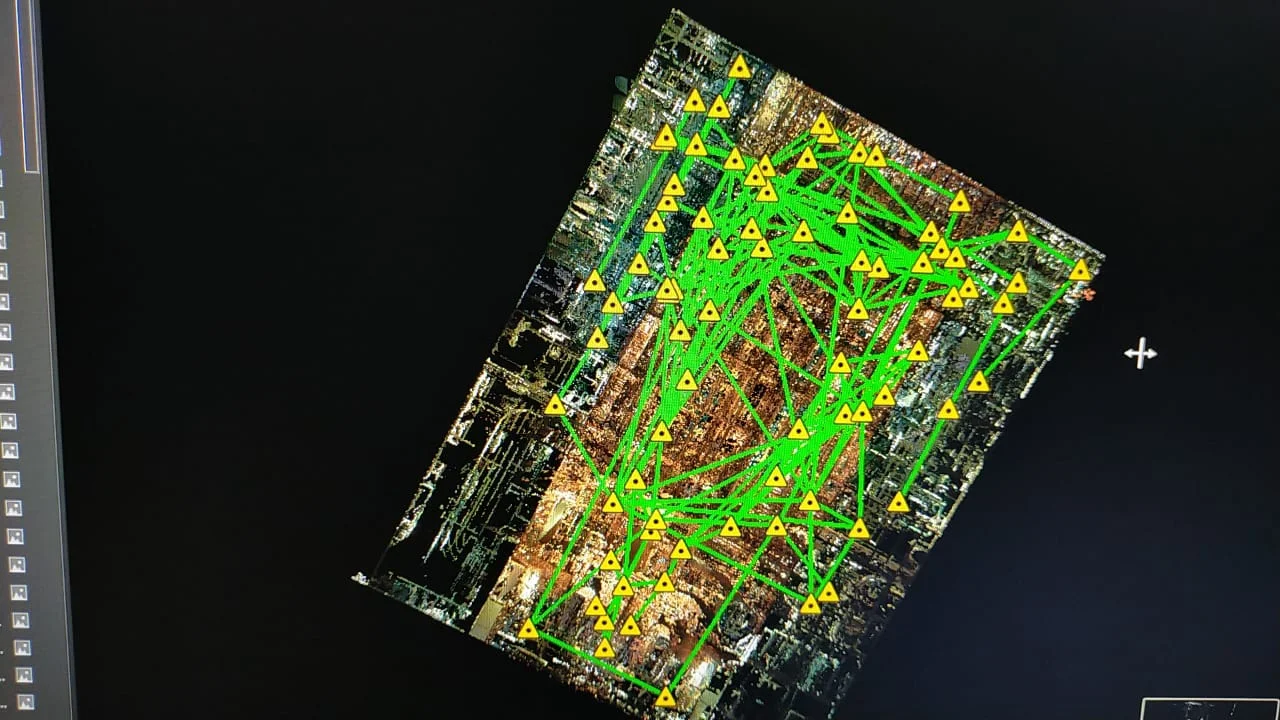
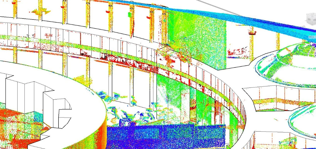
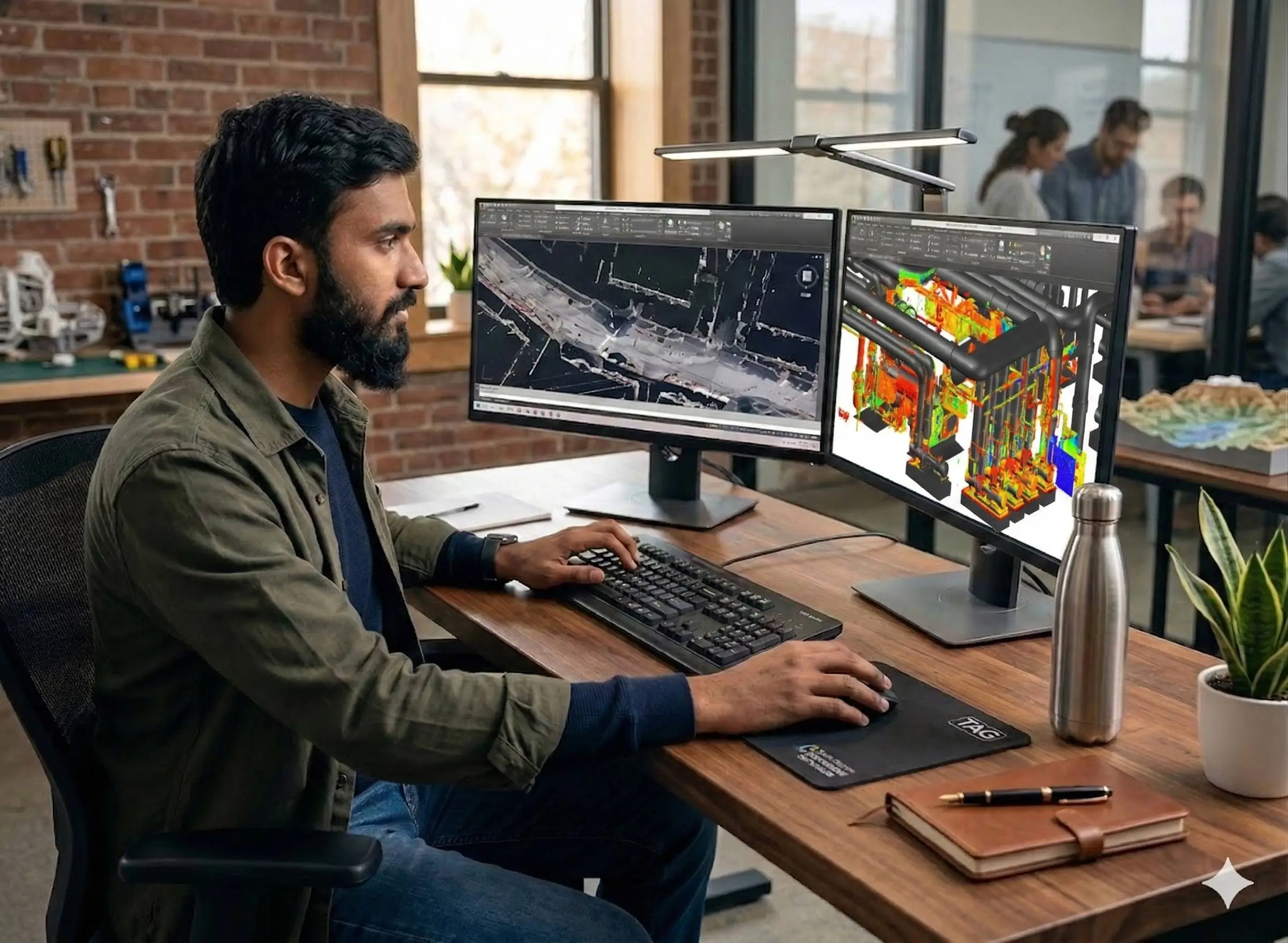
Point Cloud Registration
Multi-station scan alignment into a unified coordinate system with noise filtering and quality checks.
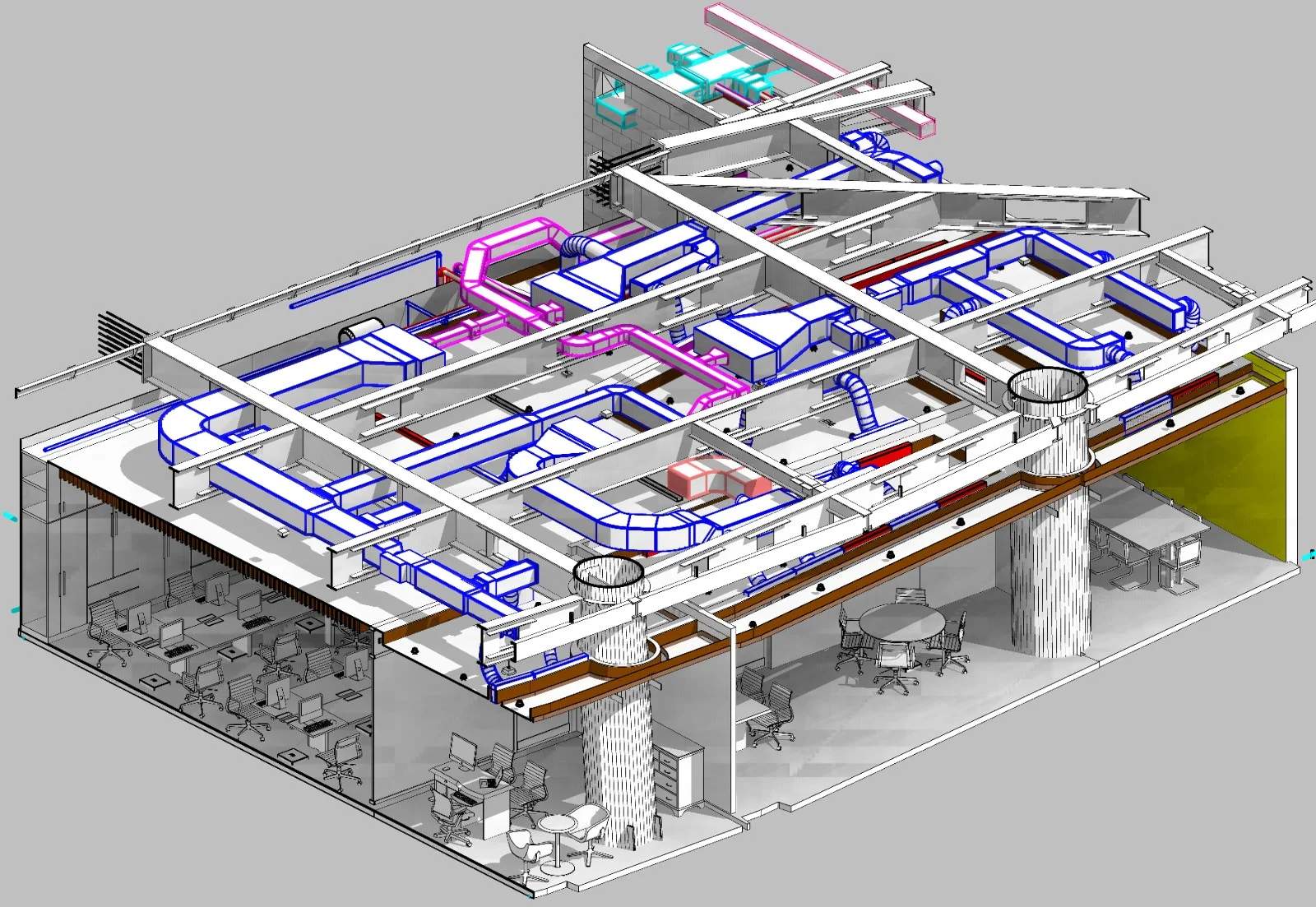
Drawing & Model Extraction
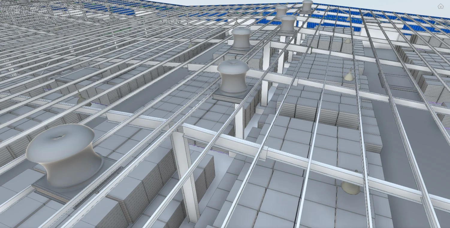
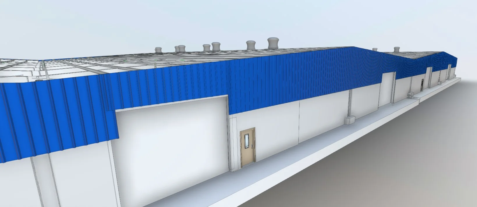
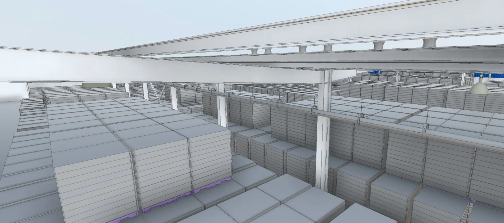
Production of floor plans, sections, elevations, and 3D models from verified point cloud data.
Applications
Industry sectors and use cases we serve
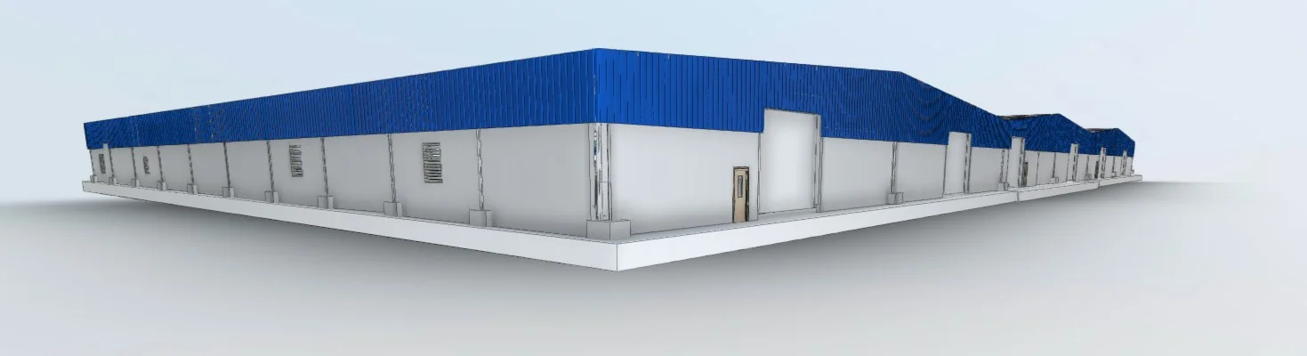
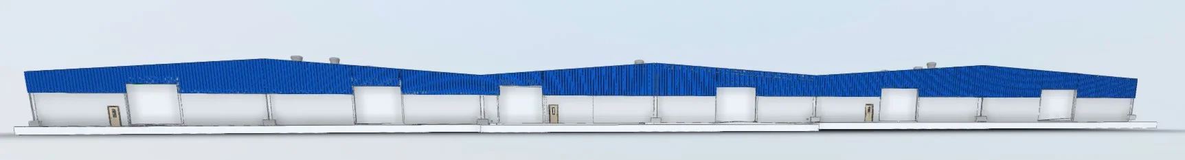
As-Built Documentation
Captures existing building geometry for reference and verification
Renovation & Fit-Out Projects
Provides verified geometry before modification works begin
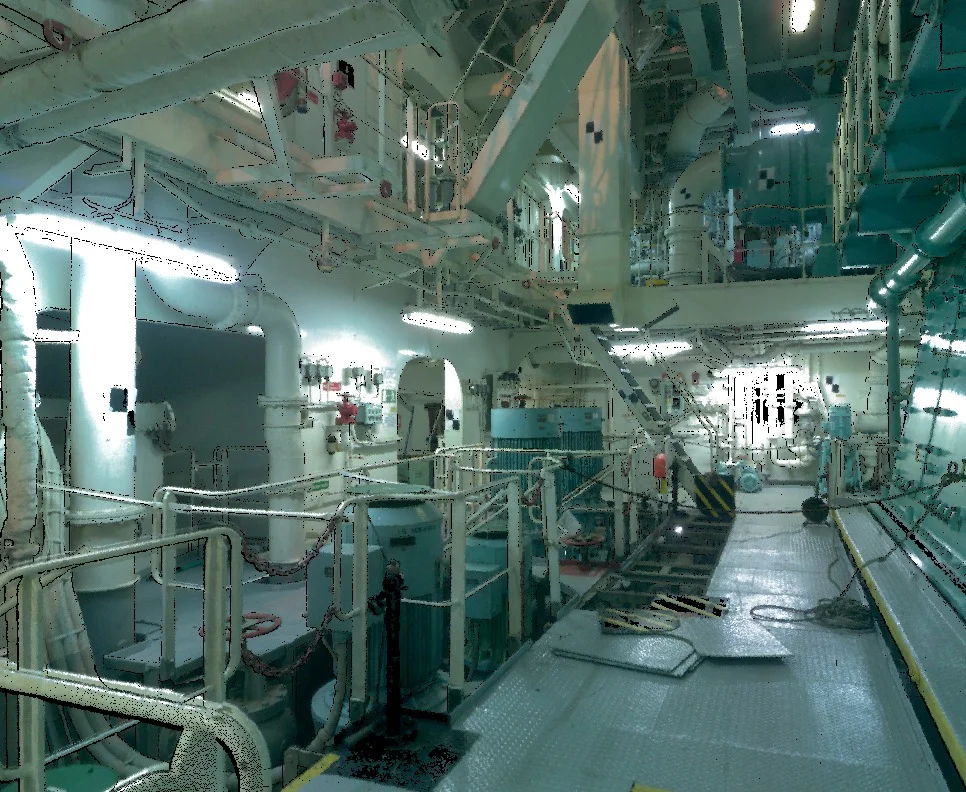
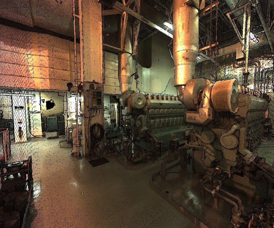
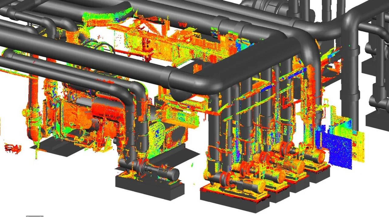
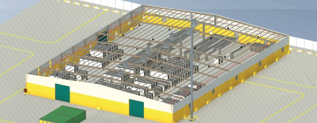
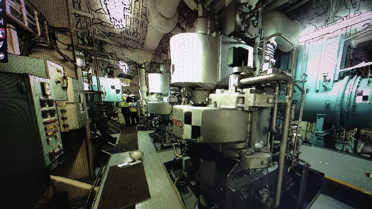
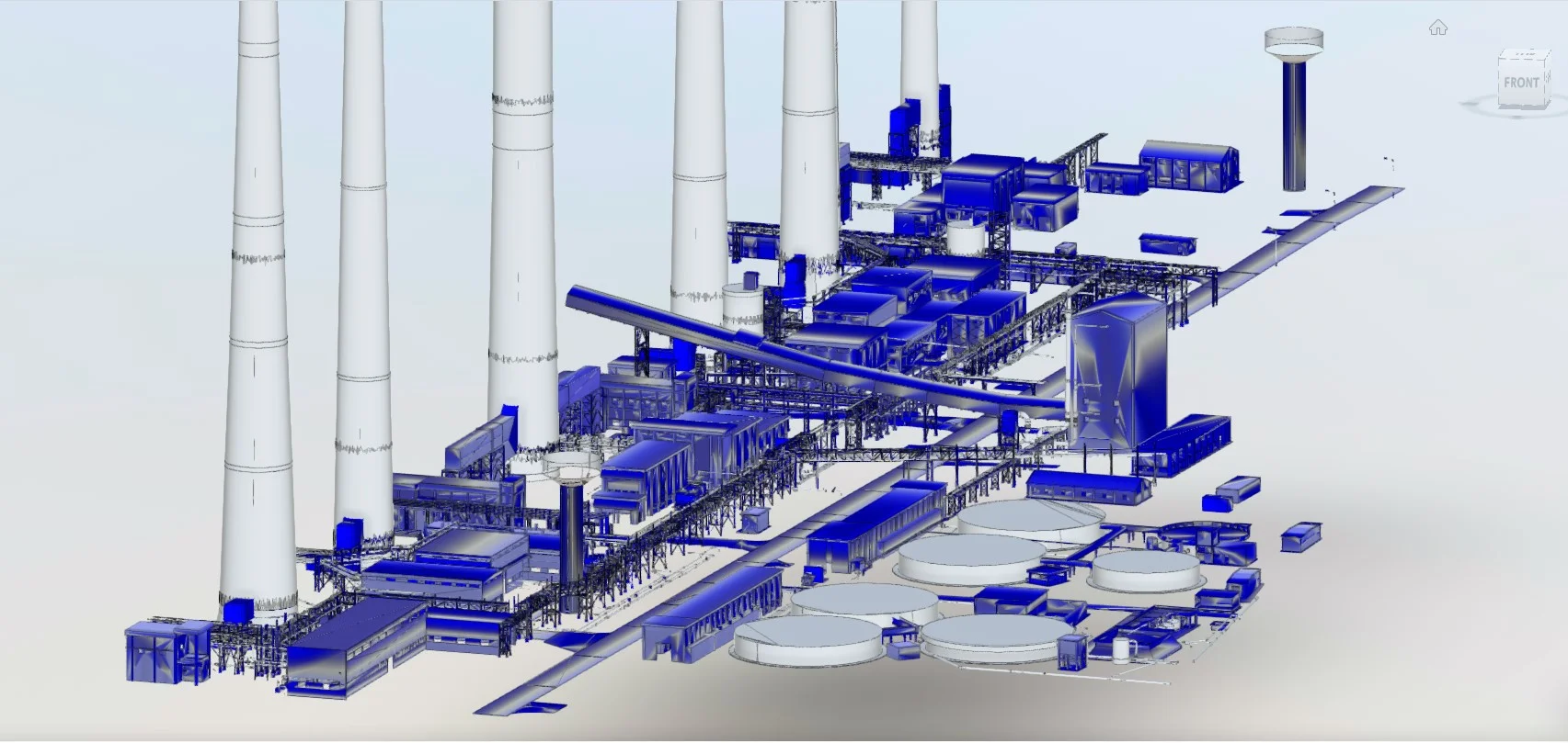
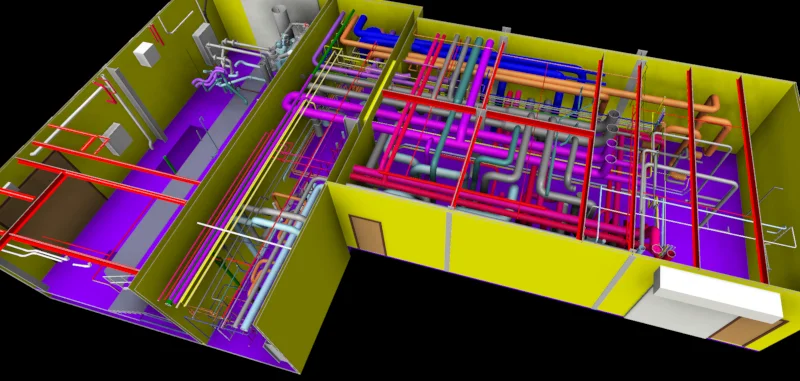
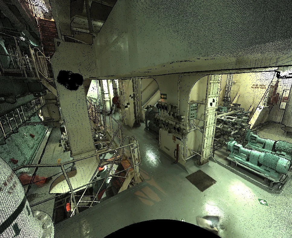
Industrial Plant & MEP Capture
Scans complex environments for coordination and clash detection
Structural Deviation Analysis
Compares scanned geometry to design drawings
Heritage & Facade Documentation
Records architectural detail with sub-cm accuracy
Deliverables
What you receive at the end of every project
- Registered point cloudRCP / E57 / LAS
- 3D mesh models
- Floor plans, elevations, and sections
- Structural layout drawings
- BIM-ready Revit models
- Deviation analysis reports
- Survey accuracy statement


Technology Stack
Industry-leading equipment and software
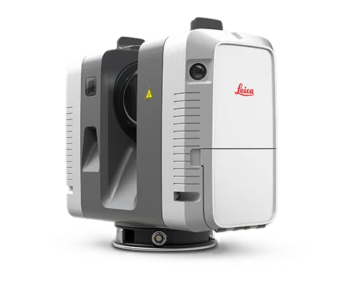
Leica RTC360
Advanced surveying technology for precision data capture and analysis.
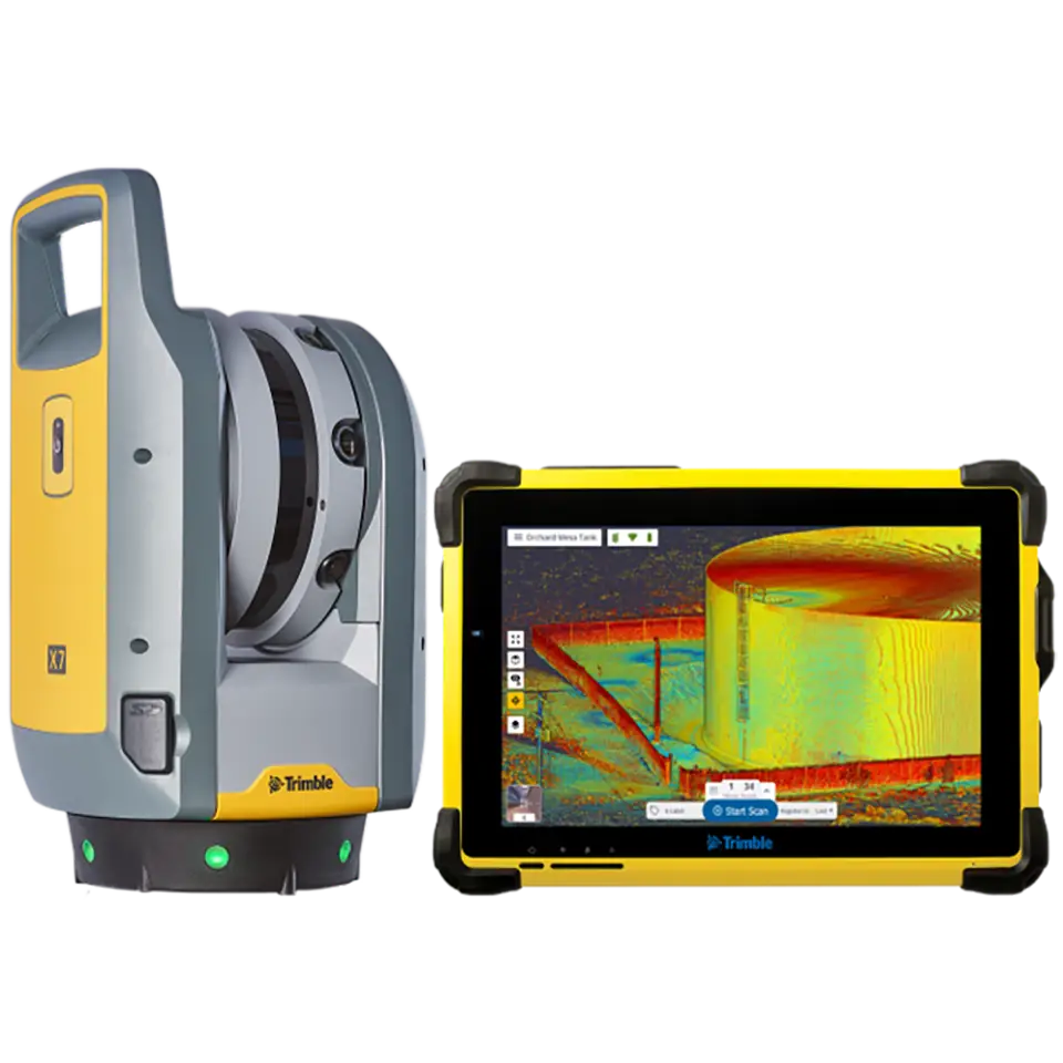
Trimble X7
Advanced surveying technology for precision data capture and analysis.
Cyclone REGISTER 360
Advanced surveying technology for precision data capture and analysis.
CloudCompare
Advanced surveying technology for precision data capture and analysis.
AutoCAD
Advanced surveying technology for precision data capture and analysis.
Frequently Asked Questions
A 3D laser survey uses a terrestrial LiDAR scanner to capture millions of precise measurement points across a structure, creating a detailed 3D point cloud used for documentation, modelling, and analysis.
Using Leica and Trimble equipment with proper control networks, we achieve 2-5mm accuracy on structures, suitable for all engineering and BIM applications.
Yes. We extract floor plans, elevations, and sections from the point cloud and produce BIM-ready Revit models. The point cloud can also be imported directly into Revit.
Typical delivery is 5-7 working days after field scanning, depending on structure size and required deliverable types.
Have more questions?
Our team of experts is ready to assist you with your specific project requirements across the GCC.
Related Services
Explore our other professional surveying solutions
3D Laser Scanning
High-precision terrestrial laser scanning for detailed 3D capture of buildings, structures, and industrial environments.
As-Built Surveys (3D Laser Scanning-Based)
High-accuracy 3D laser scanning for documentation and verification of existing building structures, including slab levels, core walls, and structural geometry.
BIM Modeling
Creation of structured Building Information Models from survey, LiDAR, and 3D scan data.
Contact us directly
Reach our team instantly via WhatsApp, phone, or email.
Also available in Riyadh