Point Cloud Survey UAE
High-density 3D point cloud surveys across the UAE using terrestrial LiDAR and mobile scanning. Millimetre-accurate datasets for BIM, as-built documentation, and infrastructure mapping.
Point Cloud Survey Services Across the UAE
A point cloud survey uses terrestrial LiDAR scanners to capture tens of millions of precise 3D measurement points across a structure, site, or corridor. The resulting georeferenced point cloud is a complete, measurable digital record of the surveyed environment — accurate to within 2–5 mm — used for as-built documentation, BIM modelling, deviation analysis, and infrastructure planning.
Al Warqa Survey Engineering delivers point cloud surveys across Dubai, Abu Dhabi, Sharjah, and all UAE emirates using Leica RTC360 and Trimble X7 scanners. We deliver E57, RCP, and LAS datasets registered to the project coordinate system, with drawings and BIM models extracted on request.
Our Methodology
Delivering excellence through a proven three-stage workflow
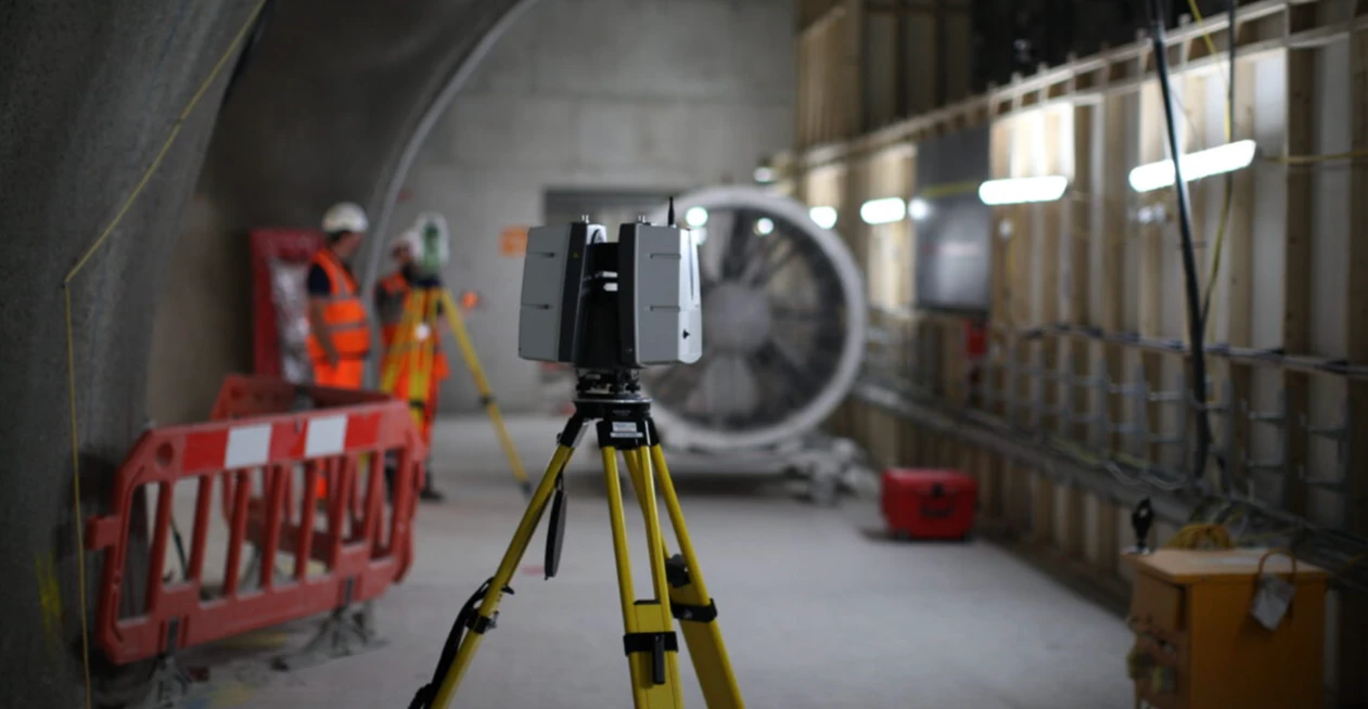
Control Network & Site Setup
Survey control targets placed across the site and tied to project or national coordinate system. Scan positions planned for full coverage with target overlap.
LiDAR Data Capture
Leica RTC360 or Trimble X7 scans all required stations. Each position captures a 360° high-density point cloud. Scans typically run at 120–500k points per second.
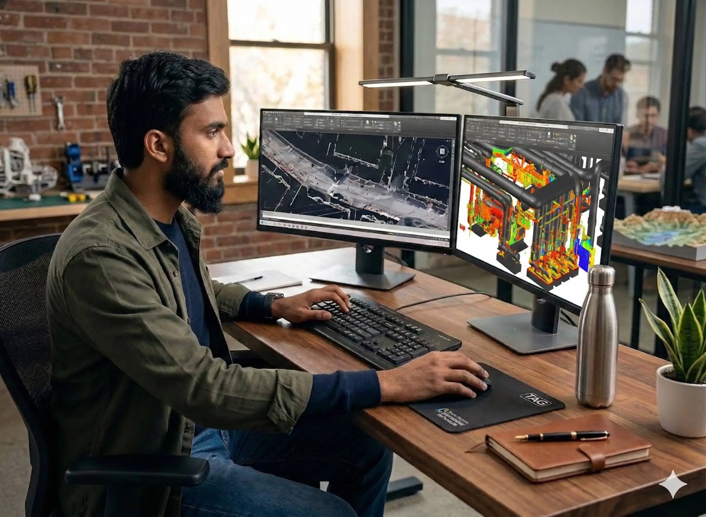
Registration & Delivery
All scan stations registered in Cyclone REGISTER 360. Point cloud cleaned, filtered, and exported in required formats. Drawings and models extracted as needed.
Applications
Industry sectors and use cases we serve
As-Built Documentation
Precise point cloud of completed structures for records and verification
Scan-to-BIM Modelling
Point cloud as input data for Revit BIM model production
Structural Deviation Analysis
Compare scanned geometry to design — detect settlement or deformation
Industrial Plant & MEP Capture
Dense point cloud of complex plant environments for coordination
Infrastructure & Road Corridor Mapping
Mobile LiDAR for rapid corridor-scale point cloud acquisition
Deliverables
What you receive at the end of every project
- Registered point cloudE57 / RCP / LAS — georeferenced, noise-filtered
- Floor plans, sections, elevationsDWG — extracted from point cloud
- BIM-ready Revit modelRVT — on request, modelled to required LOD
- Deviation reportColour-coded deviation map vs design
- Point cloud accuracy statement
Technology Stack
Industry-leading equipment and software
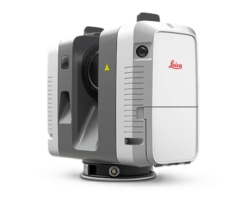
Leica RTC360
Advanced surveying technology for precision data capture and analysis.
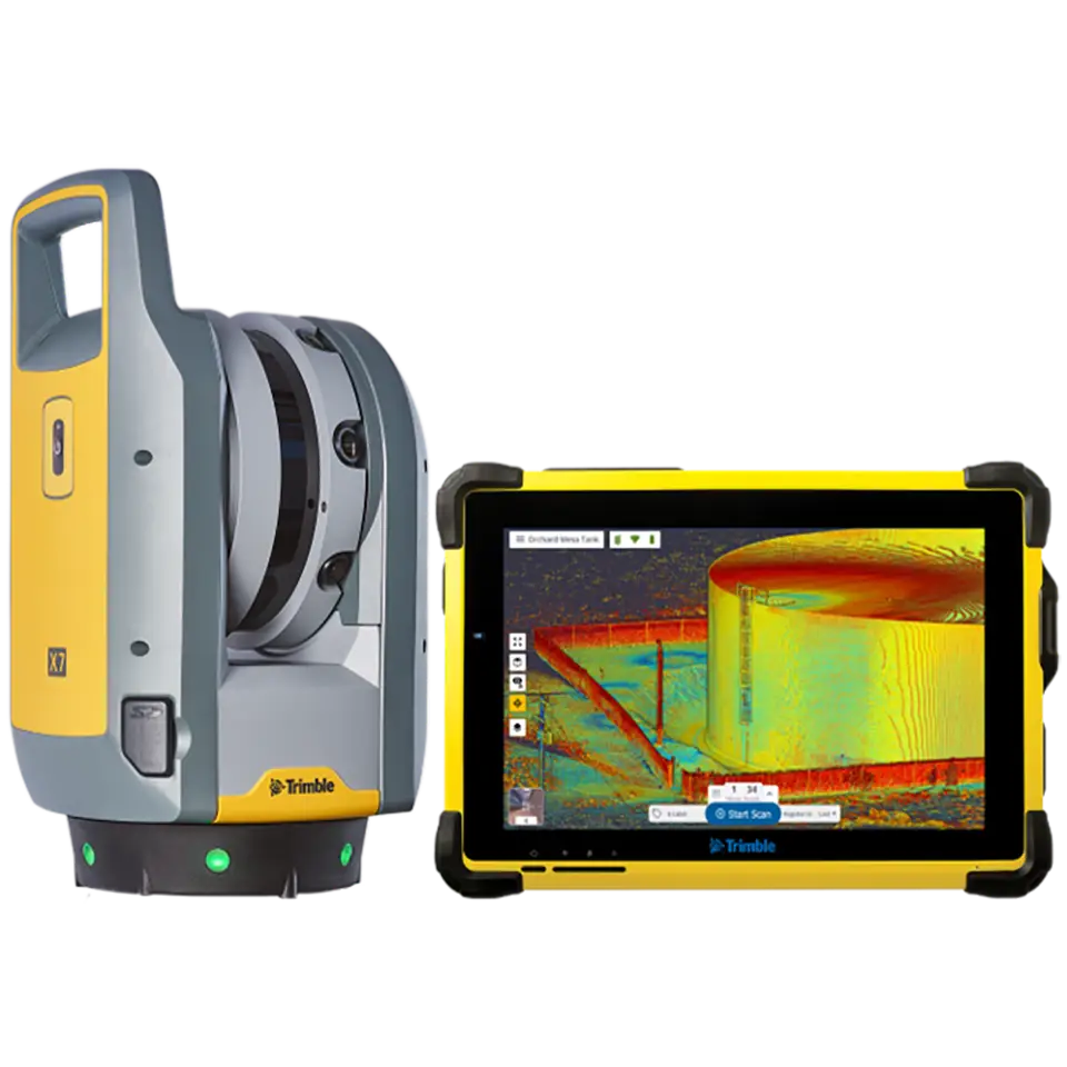
Trimble X7
Advanced surveying technology for precision data capture and analysis.
Cyclone REGISTER 360
Advanced surveying technology for precision data capture and analysis.
CloudCompare
Advanced surveying technology for precision data capture and analysis.
AutoCAD
Advanced surveying technology for precision data capture and analysis.
Frequently Asked Questions
A point cloud survey uses a terrestrial LiDAR scanner to capture millions of precise 3D coordinates across a structure or site. The result is a dense digital model — accurate to 2–5 mm — that can be measured, sectioned, and converted into drawings or BIM models.
We deliver E57, RCP, and LAS/LAZ point cloud formats. AutoCAD DWG drawings and Revit RVT models can also be produced from the point cloud data.
Using Leica RTC360 scanners with properly surveyed control targets, we achieve 2–5 mm overall accuracy across a registered multi-station project — suitable for all engineering, BIM, and authority submission applications.
Yes. Our teams cover Dubai, Abu Dhabi, Sharjah, Ajman, Ras Al Khaimah, Fujairah, and Umm Al Quwain. We also operate in Saudi Arabia.
Yes. Floor plans, elevations, sections, and structural layouts can all be extracted directly from the registered point cloud. We can also model the point cloud in Revit to the required LOD for BIM deliverables.
Have more questions?
Our team of experts is ready to assist you with your specific project requirements across the GCC.
Related Services
Explore our other professional surveying solutions
3D Laser Scanning
High-precision terrestrial laser scanning for detailed 3D capture of buildings, structures, and industrial environments.
3D Laser Survey Dubai
High-accuracy 3D laser scanning services in Dubai for buildings, infrastructure, and industrial facilities. Point cloud capture to millimetre-level precision.
Scan to BIM UAE
Professional Scan-to-BIM services across the UAE. We laser scan existing buildings and convert the point cloud into accurate Revit models at LOD 200–500 for renovation, clash detection, and facility management.
Contact us directly
Reach our team instantly via WhatsApp, phone, or email.
Also available in Riyadh