Scan to BIM UAE
Professional Scan-to-BIM services across the UAE. We laser scan existing buildings and convert the point cloud into accurate Revit models at LOD 200–500 for renovation, clash detection, and facility management.
Scan to BIM Services in the UAE
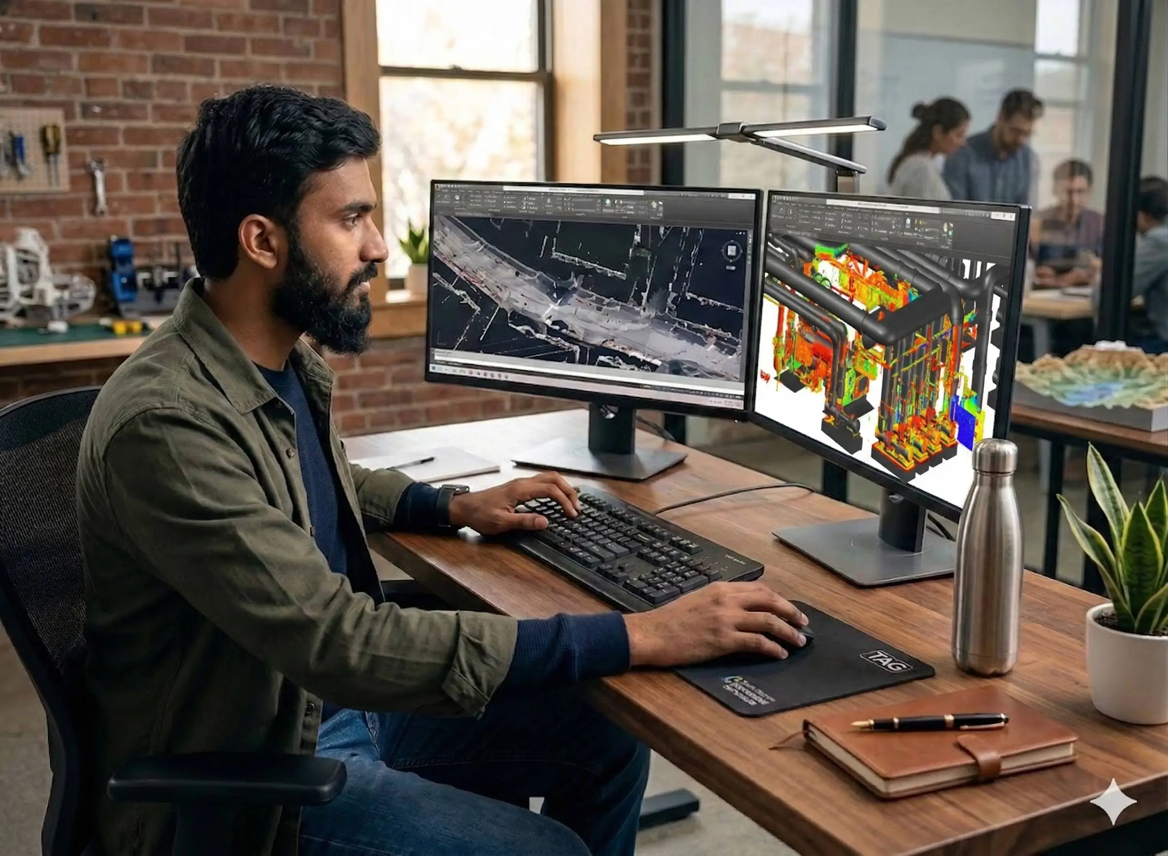
Scan-to-BIM is the process of converting a 3D laser scan of an existing building or structure into a structured, intelligent Revit BIM model. Al Warqa Survey Engineering delivers end-to-end Scan-to-BIM services across the UAE — from terrestrial LiDAR scanning to final Revit model delivery — under one contract.
Our Scan-to-BIM workflow uses Leica RTC360 and Trimble X7 scanners to capture millimetre-accurate point clouds, which are then modelled in Autodesk Revit to the required Level of Development. Clients receive authority-ready BIM models for Dubai Municipality, DEWA, and other UAE regulatory submissions.
Our Methodology
Delivering excellence through a proven three-stage workflow
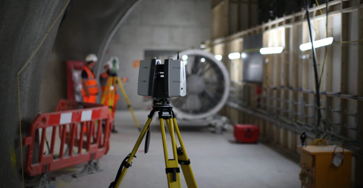
3D Laser Scanning
Leica RTC360 or Trimble X7 deployed on site. Control targets set for georeferencing. Full structure captured at all required scan stations.
Point Cloud Registration
All scan stations registered in Cyclone REGISTER 360 into a single unified coordinate system. Noise filtering and quality checks applied.
BIM Modelling & Delivery
Point cloud imported into Revit via ReCap Pro. Elements modelled to required LOD. IFC export, 2D drawings, and accuracy statement produced for client.
Applications
Industry sectors and use cases we serve
Renovation & Fit-Out Projects
Accurate as-existing Revit models for hotel, commercial, and residential refurbishment
MEP Coordination
Clash-free MEP models built from real as-built geometry
Facility Management
LOD 500 as-built models for CAFM integration and lifecycle management
Heritage Documentation
BIM models of heritage and conservation structures from laser scan data
Deliverables
What you receive at the end of every project
- Revit BIM modelRVT — architectural, structural, MEP to required LOD
- Registered point cloudE57 / RCP — georeferenced to project coordinate system
- IFC exportIFC 2x3 / IFC 4 for open BIM workflows
- 2D drawings from modelDWG — floor plans, sections, elevations
- Model accuracy statement
Technology Stack
Industry-leading equipment and software
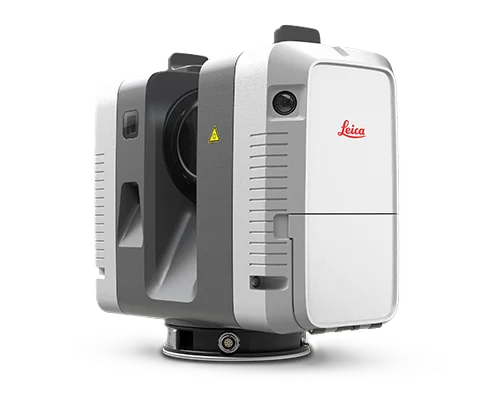
Leica RTC360
Advanced surveying technology for precision data capture and analysis.
Autodesk Revit
Advanced surveying technology for precision data capture and analysis.
Cyclone REGISTER 360
Advanced surveying technology for precision data capture and analysis.
ReCap Pro
Advanced surveying technology for precision data capture and analysis.
Navisworks Manage
Advanced surveying technology for precision data capture and analysis.
Frequently Asked Questions
Scan-to-BIM is the process of using a 3D laser scanner to capture the precise geometry of an existing building, then modelling that geometry in Revit (or another BIM platform) to produce an accurate, intelligent building information model.
Yes. Al Warqa Survey Engineering provides the full Scan-to-BIM service — terrestrial laser scanning, point cloud registration, and Revit modelling — under a single contract. No third-party coordination required.
We model to LOD 200 through LOD 500 depending on project scope. LOD 300 is typical for renovation coordination; LOD 500 for full as-built facility management models.
A single commercial floor typically takes 1–2 weeks from scanning to model delivery. Multi-floor buildings take 3–6 weeks. Timescales depend on floor area, number of disciplines, and required LOD.
Our models are produced to DM (Dubai Municipality), DEWA, and Abu Dhabi authority standards. We can tailor LOD, file format, and coordinate system to any UAE project or authority requirement.
Have more questions?
Our team of experts is ready to assist you with your specific project requirements across the GCC.
Related Services
Explore our other professional surveying solutions
BIM Modeling Dubai
Professional BIM modeling services in Dubai and the UAE. Scan-to-BIM, Revit modeling, and LOD 100–500 models from point cloud and survey data for construction, renovation, and facility management projects.
3D Laser Scanning
High-precision terrestrial laser scanning for detailed 3D capture of buildings, structures, and industrial environments.
3D Laser Survey Dubai
High-accuracy 3D laser scanning services in Dubai for buildings, infrastructure, and industrial facilities. Point cloud capture to millimetre-level precision.
Contact us directly
Reach our team instantly via WhatsApp, phone, or email.
Also available in Riyadh