Mobile LiDAR Mapping Dubai
High-speed mobile LiDAR mapping services in Dubai for road surveys, infrastructure corridors, and urban 3D mapping. Vehicle-mounted scanning delivering dense point clouds at driving speeds.
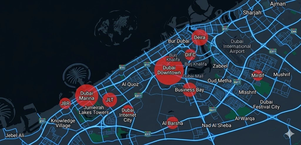
Mobile LiDAR Mapping Services in Dubai & UAE
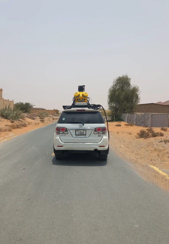
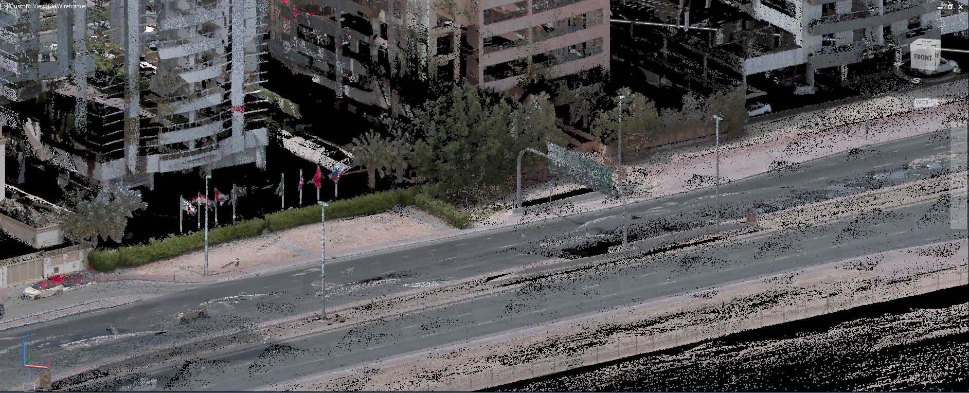
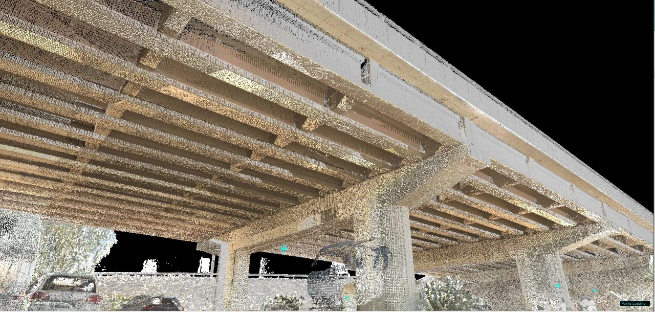
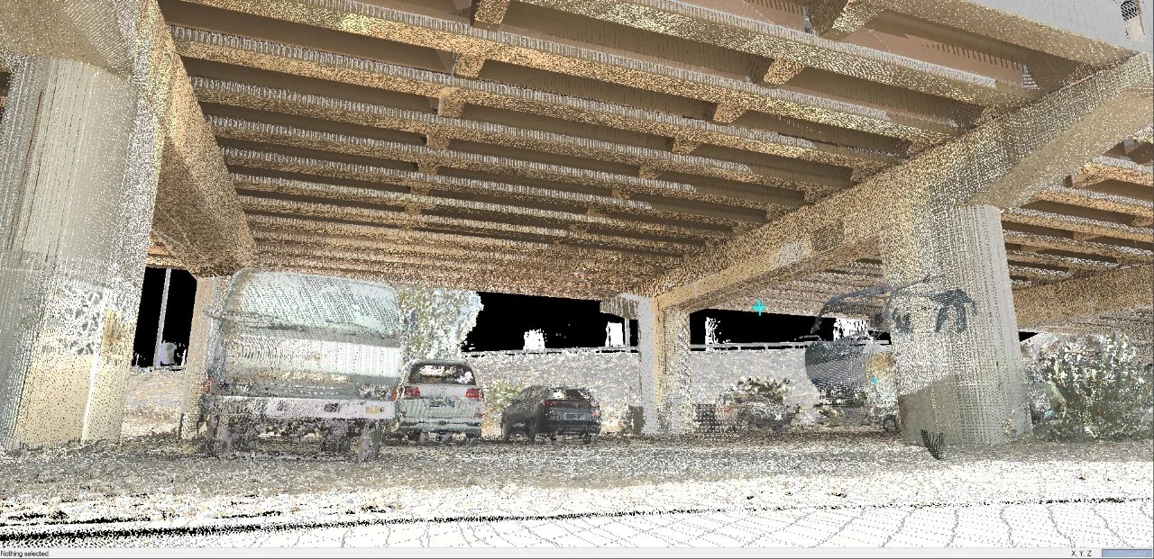
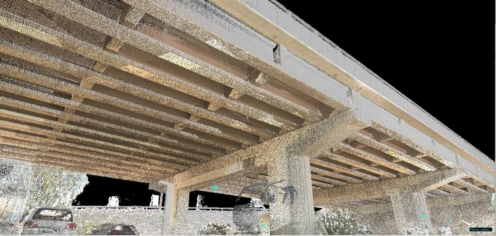
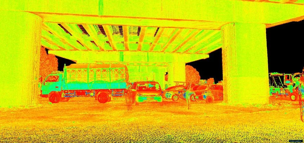
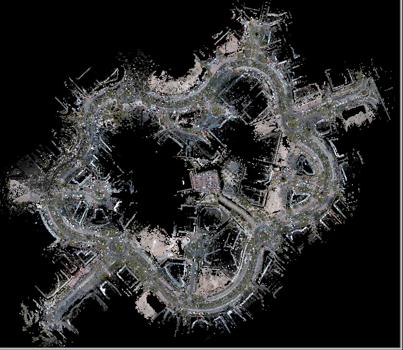
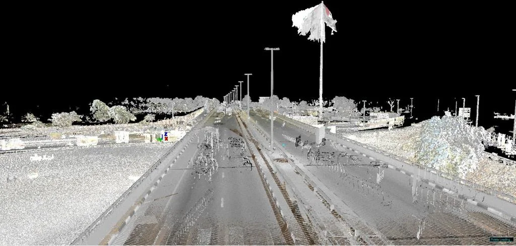
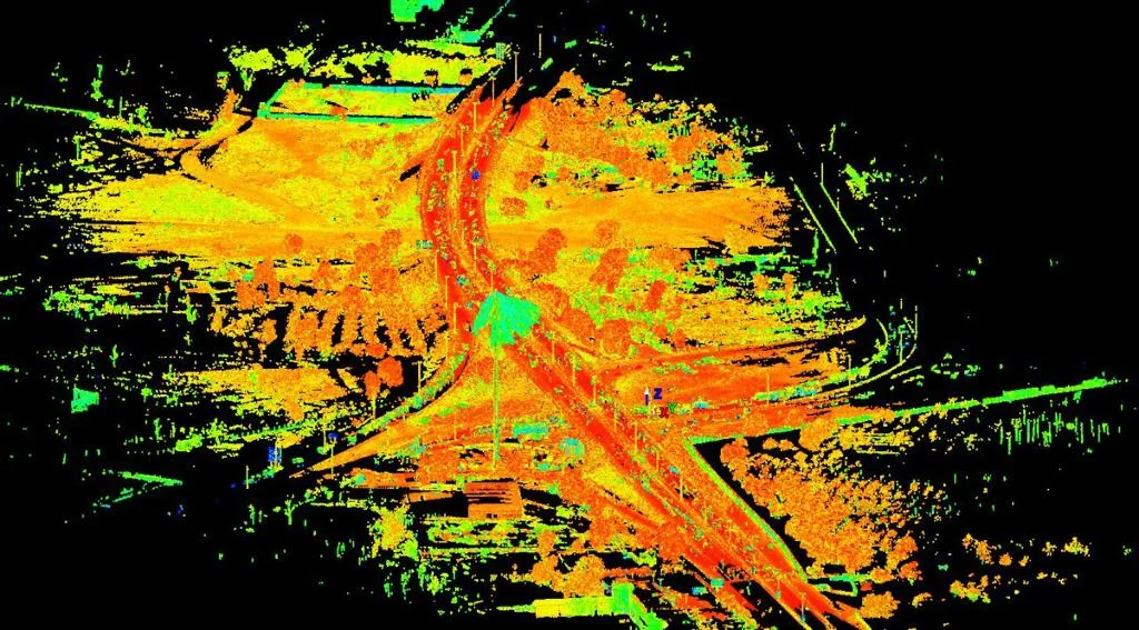
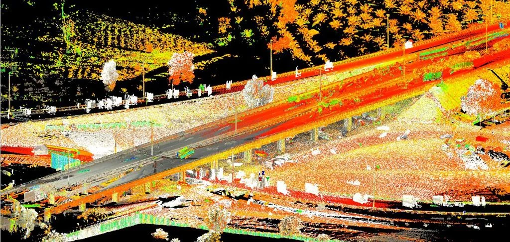
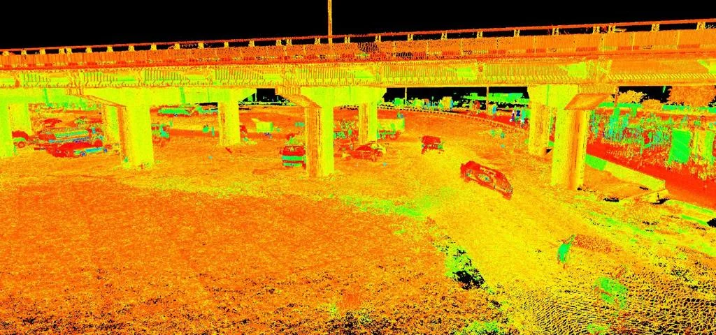
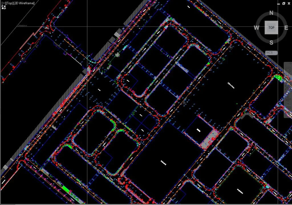
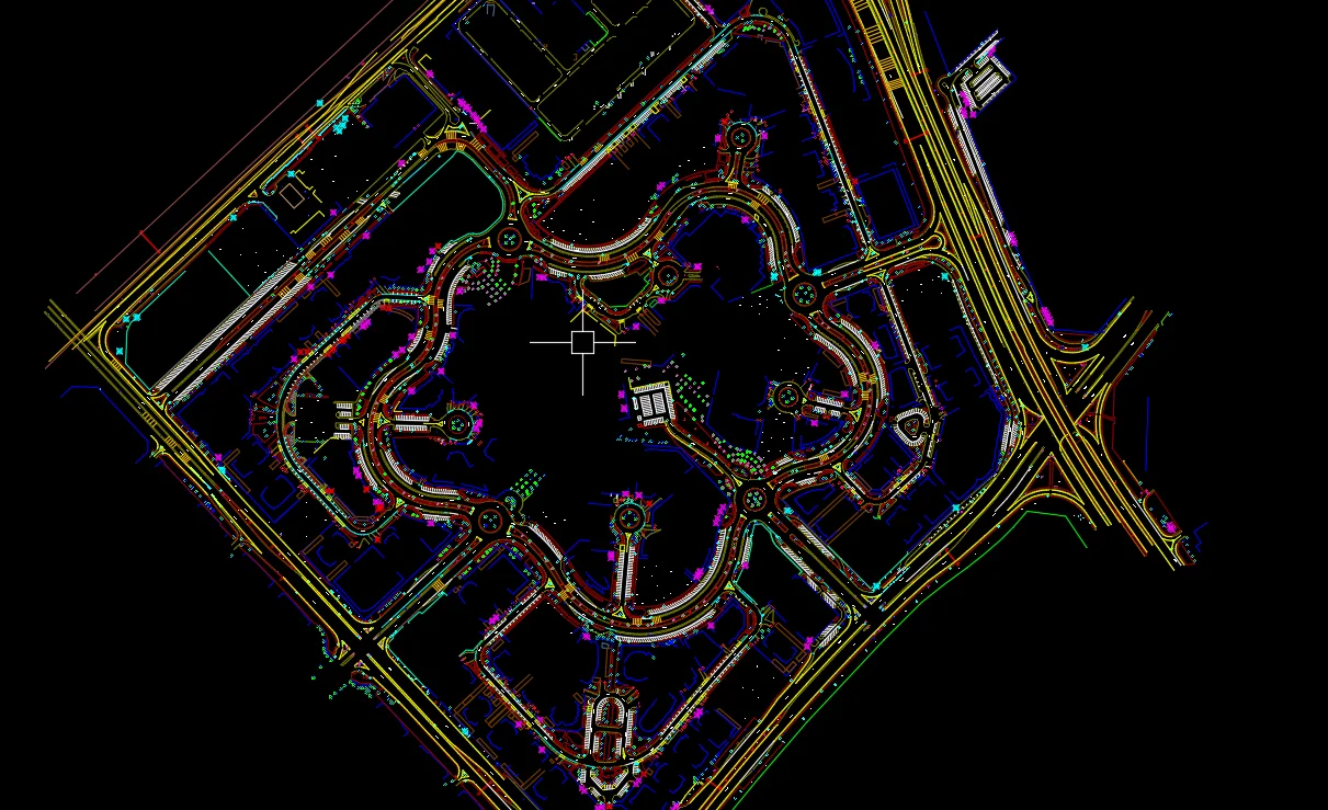
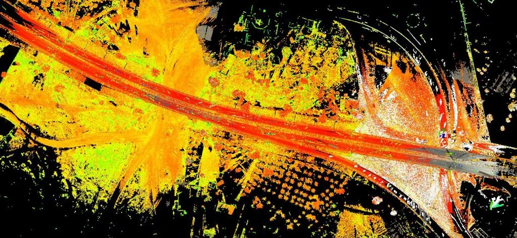
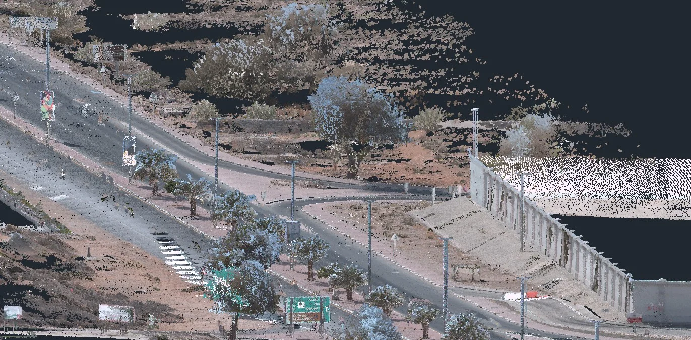
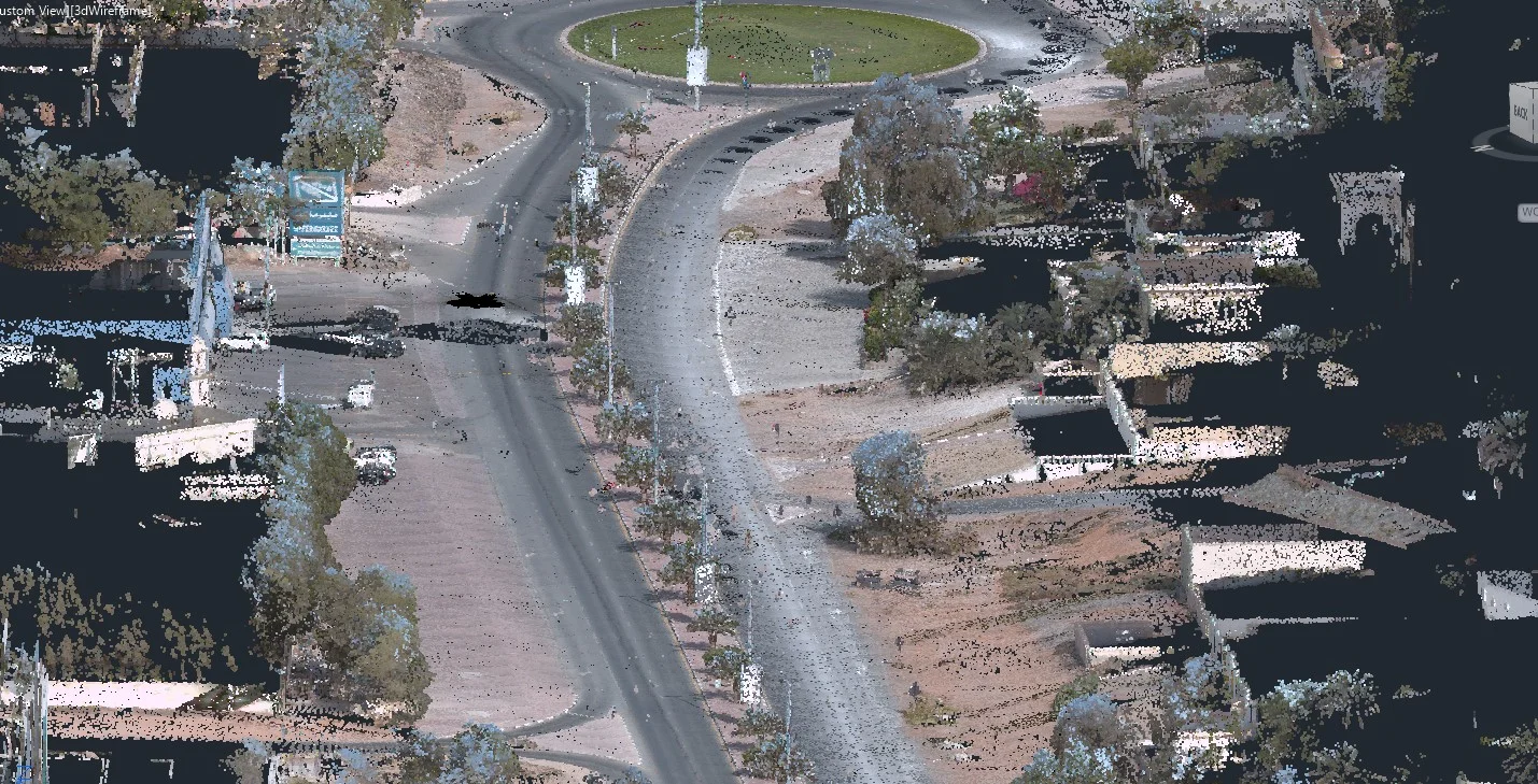
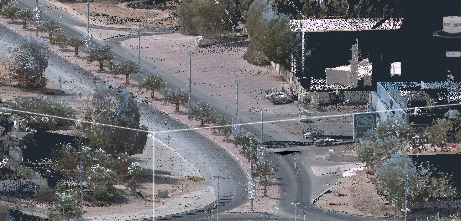
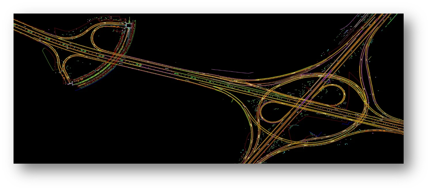
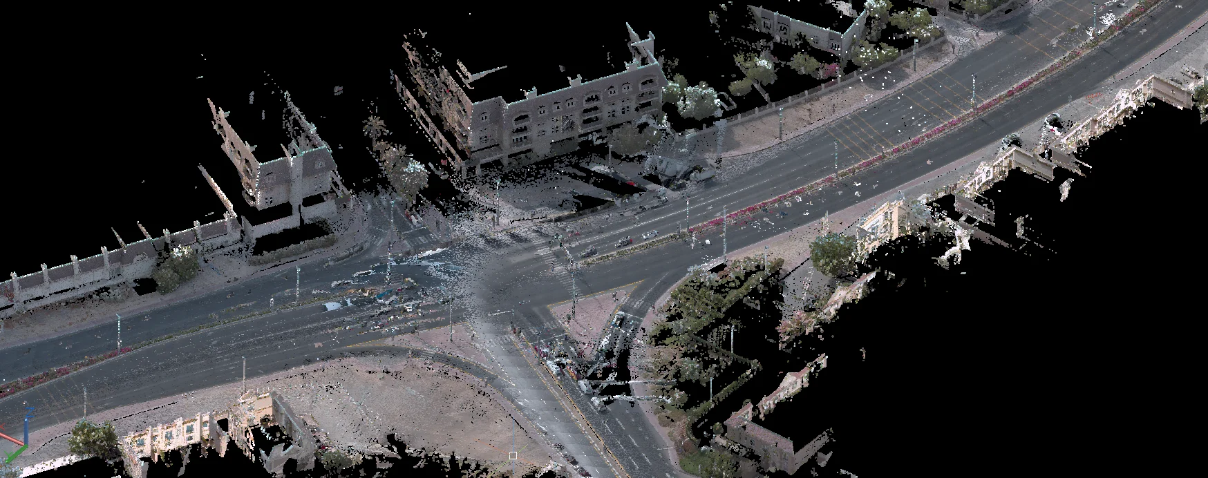
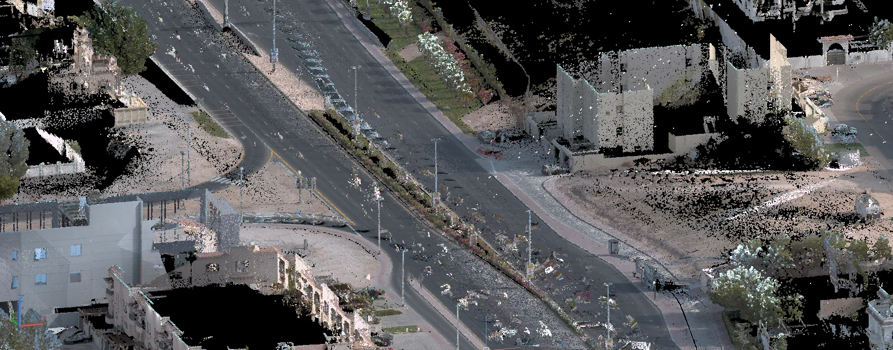
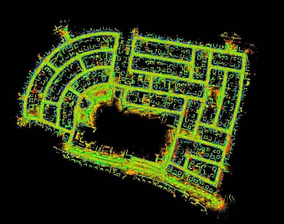
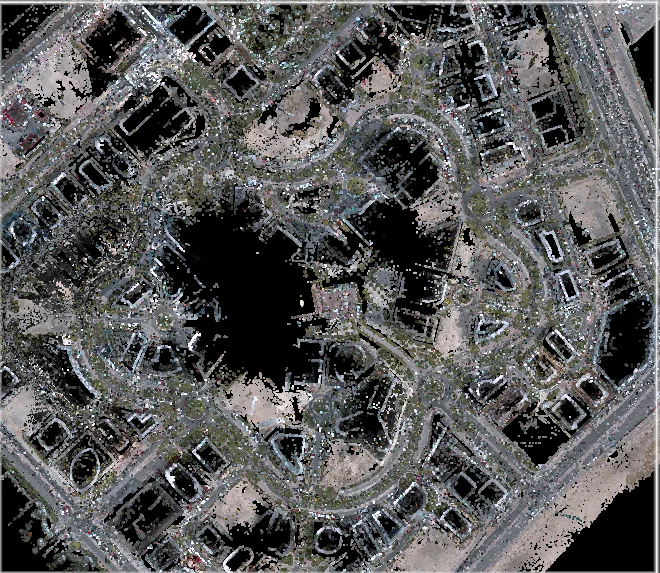
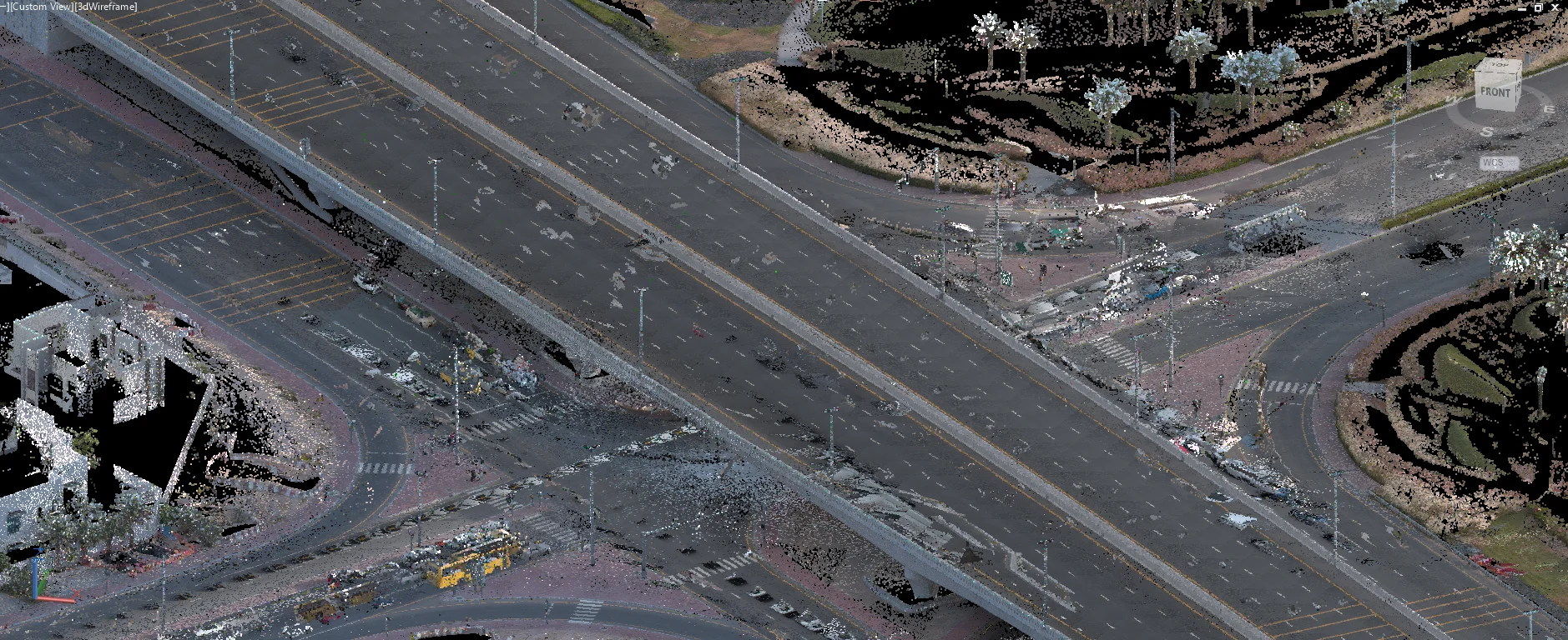
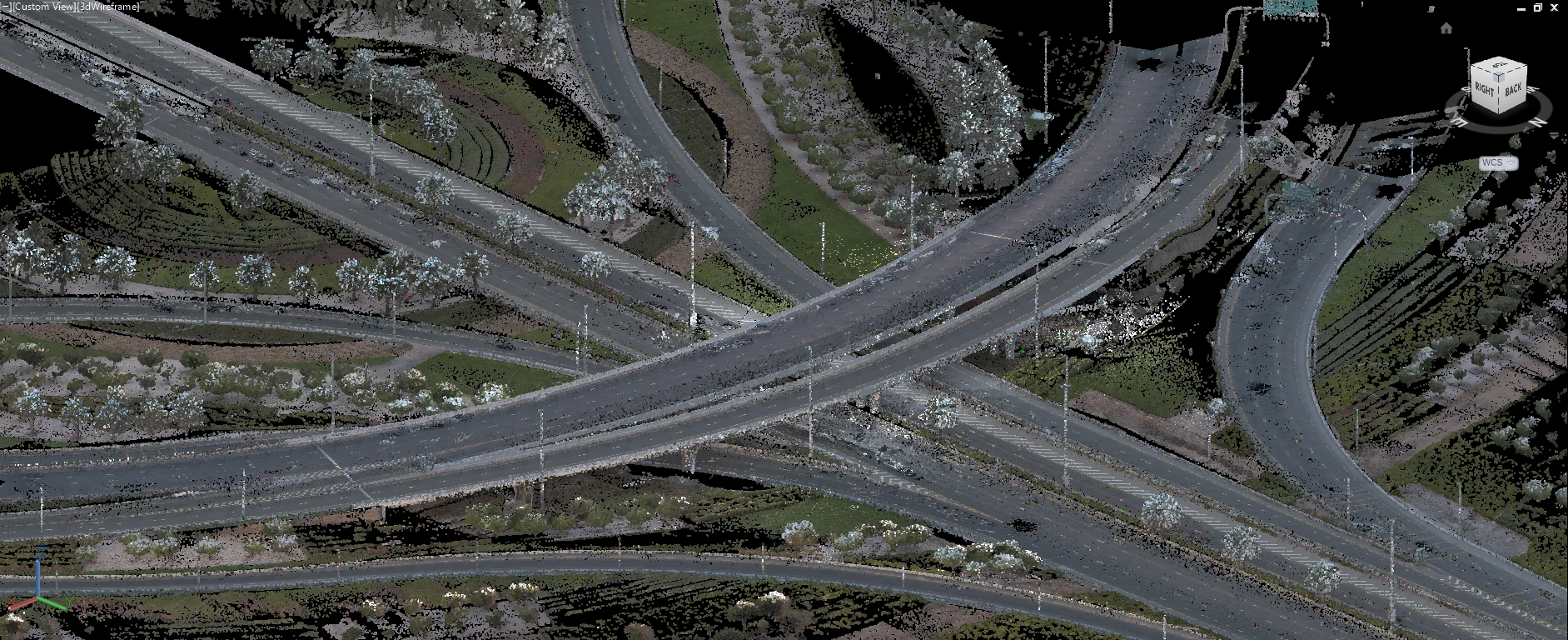
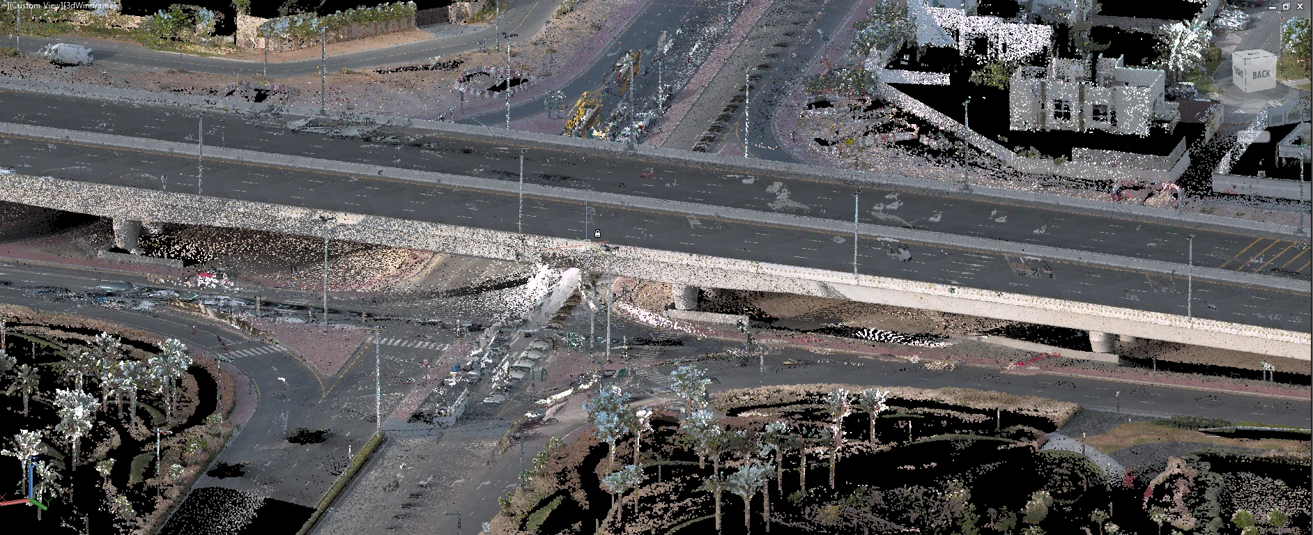
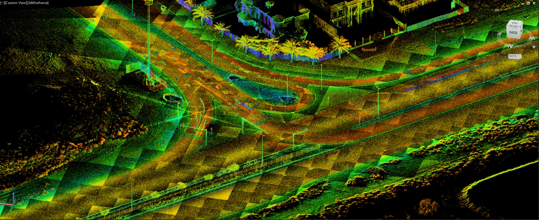
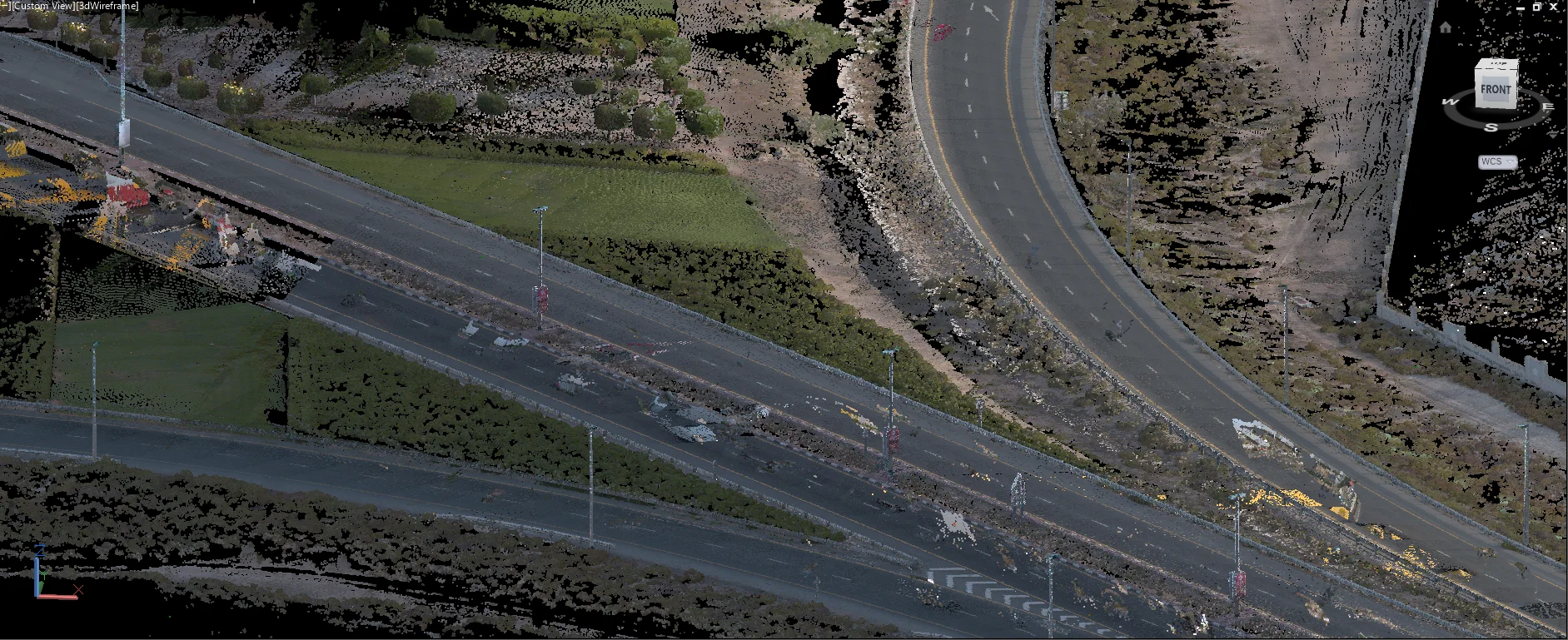
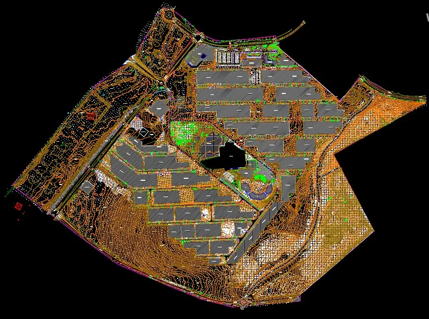
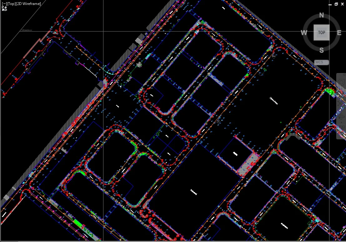
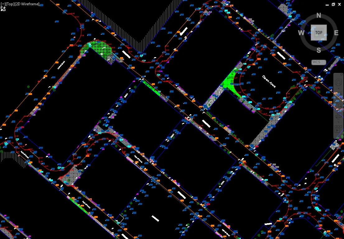
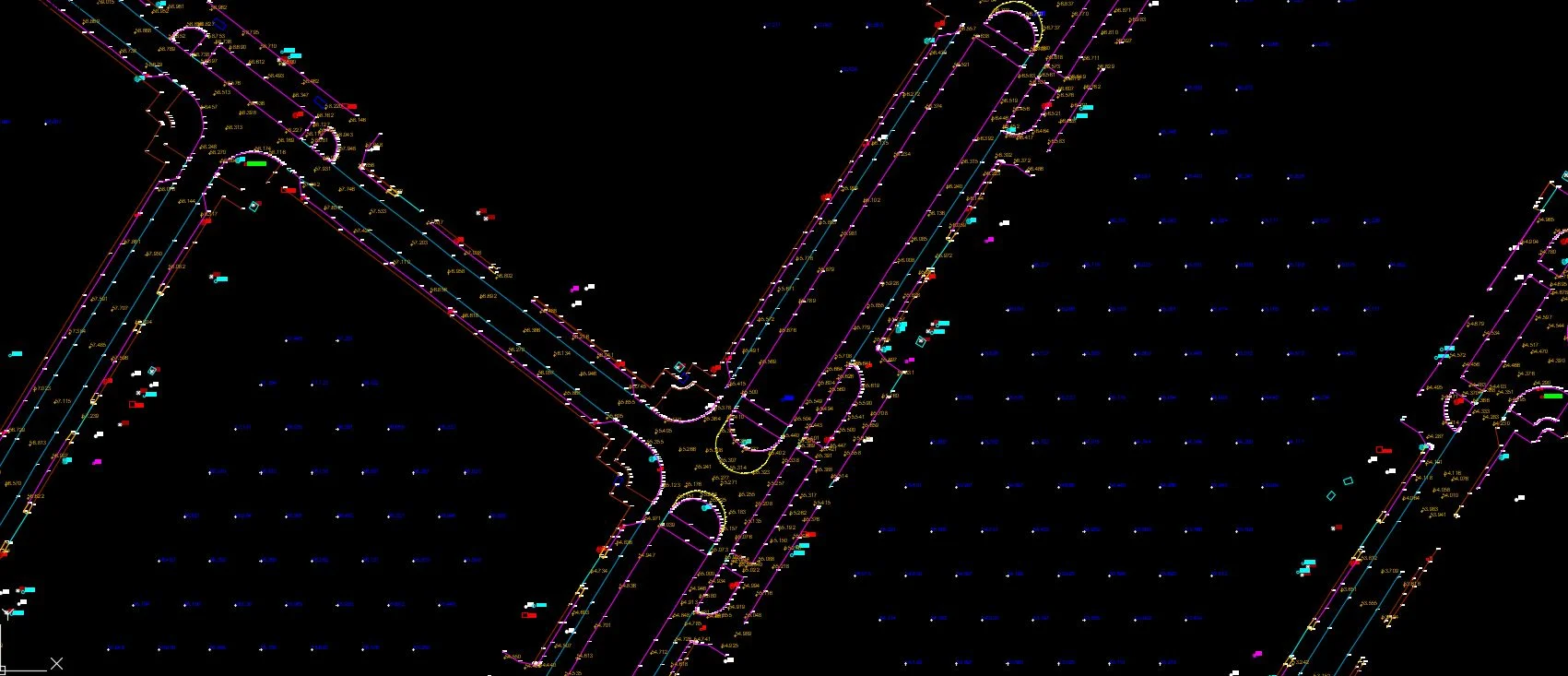
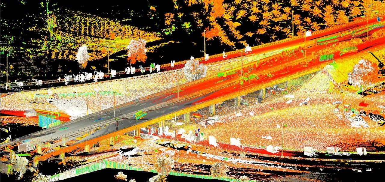
Mobile LiDAR mapping mounts high-density laser scanners on a survey vehicle to capture the complete 3D geometry of roads, streetscapes, and infrastructure corridors at normal driving speeds. The result is a dense, georeferenced point cloud covering both sides of the road, overhead structures, and the ground surface — all captured without closing the road or deploying a large field crew.
Al Warqa Survey Engineering operates mobile mapping systems across Dubai, Abu Dhabi, Sharjah, and throughout the UAE for road asset inventories, pavement surveys, utility corridor mapping, and smart city digital twin datasets.
Our Methodology
Delivering excellence through a proven three-stage workflow
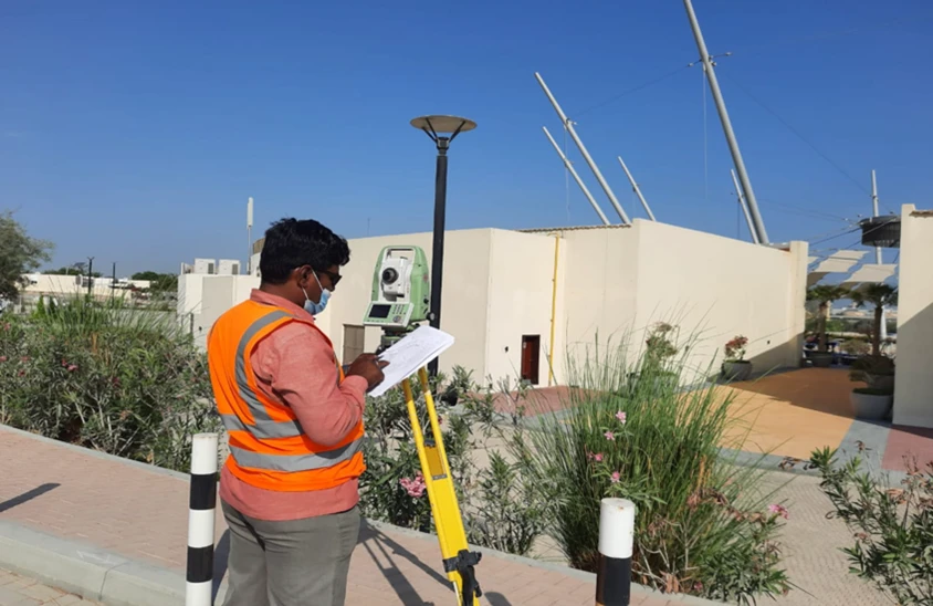
Control Network & Calibration
Establish GNSS base stations and run calibration passes to validate IMU/LiDAR boresight alignment.
Mobile Scanning Runs
Drive survey vehicle at consistent speed along planned corridor with overlapping return passes for full coverage.
Point Cloud Processing & Extraction
Process raw data, apply GNSS/INS corrections, classify ground and features, extract required deliverables.
Applications
Industry sectors and use cases we serve
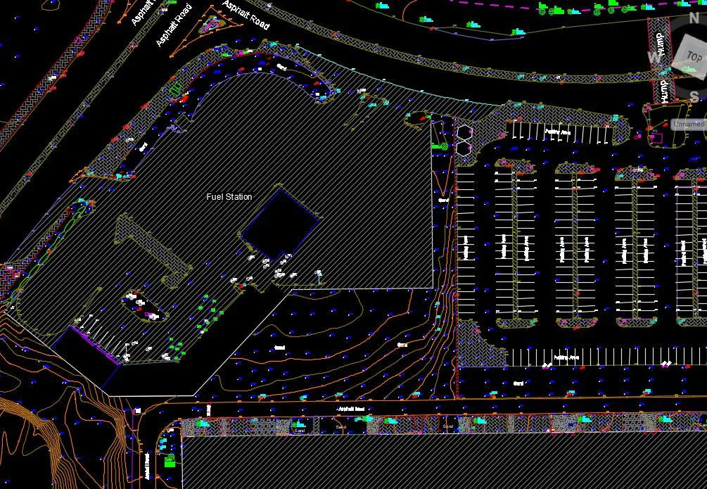
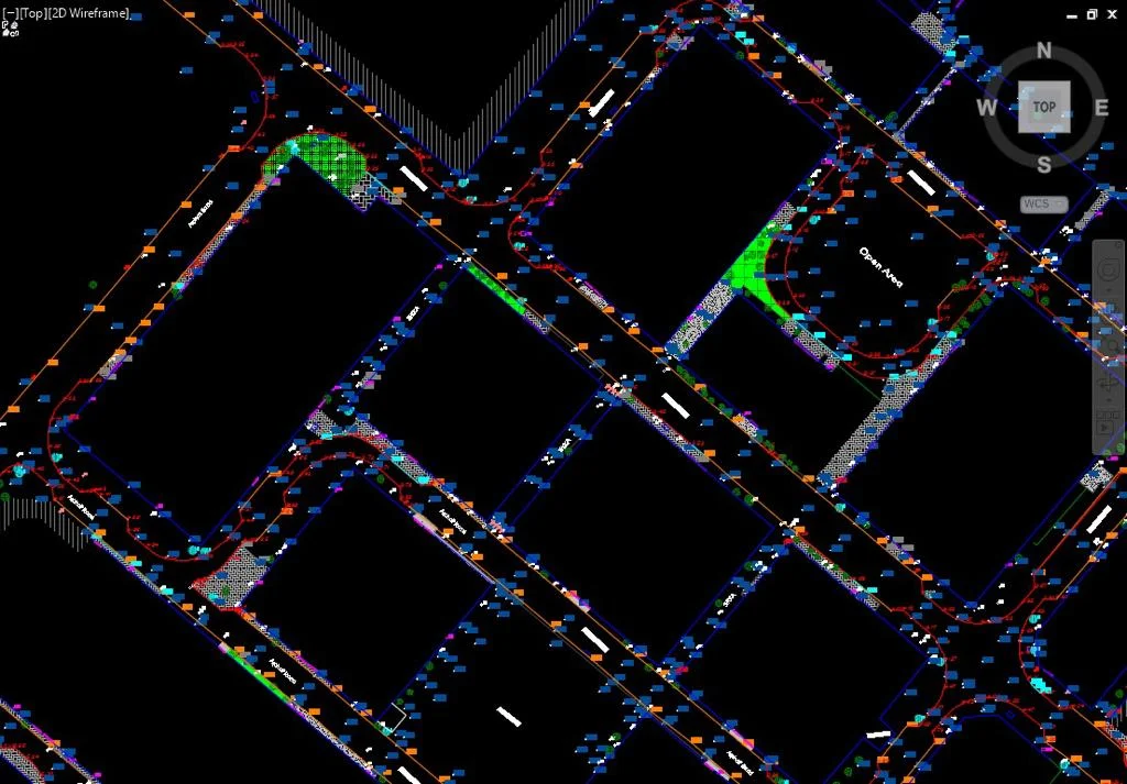
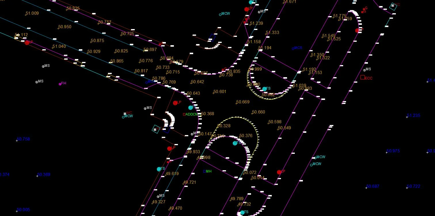
Road Asset Inventory
Signs, markings, kerbs, guardrails, and street furniture captured in one pass
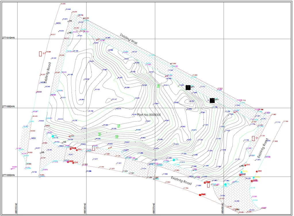
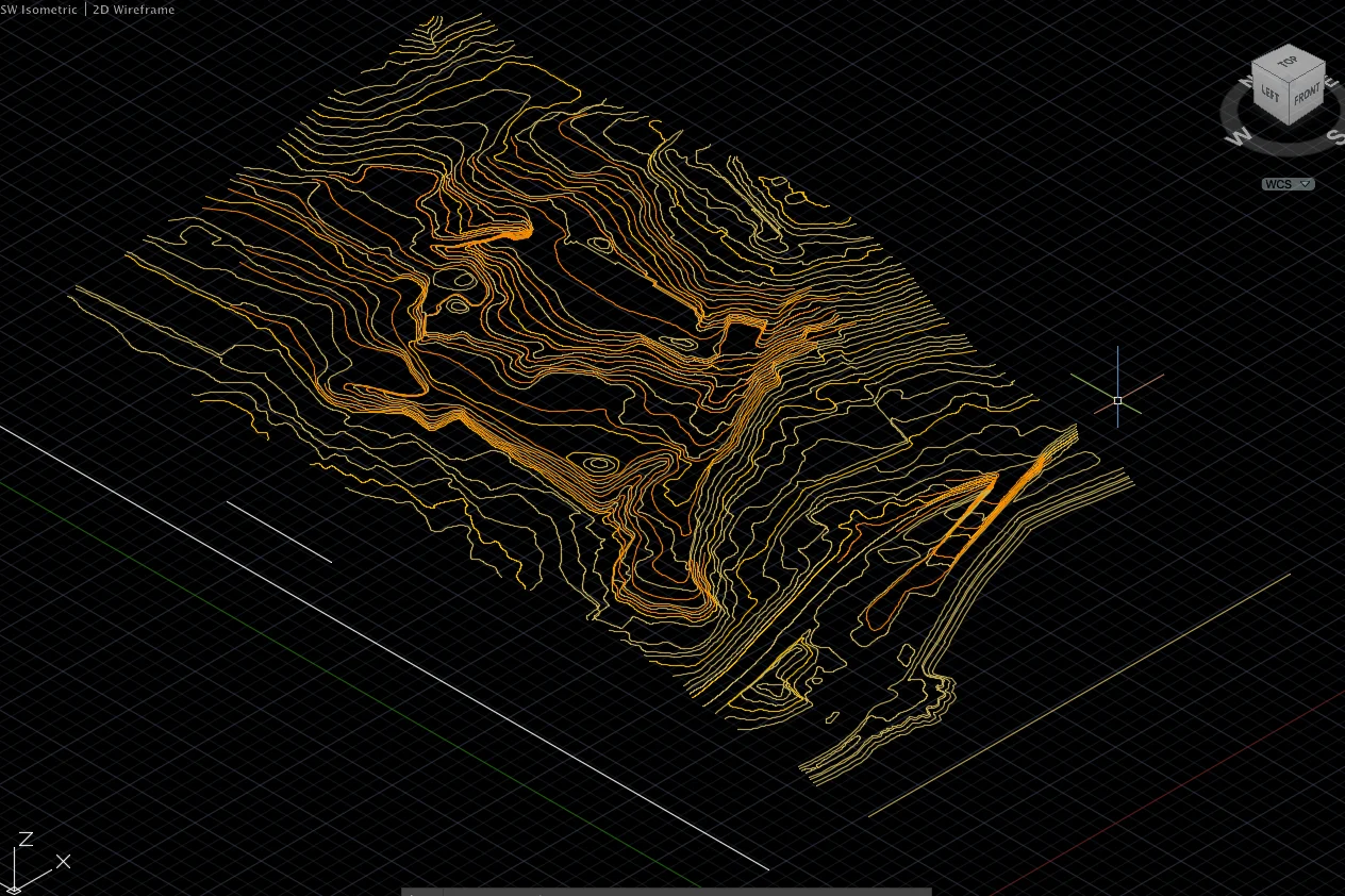
Corridor Topographic Survey
Efficient large-area terrain capture for road design and drainage
Pavement Condition Mapping
Surface geometry and cross-section extraction for pavement management
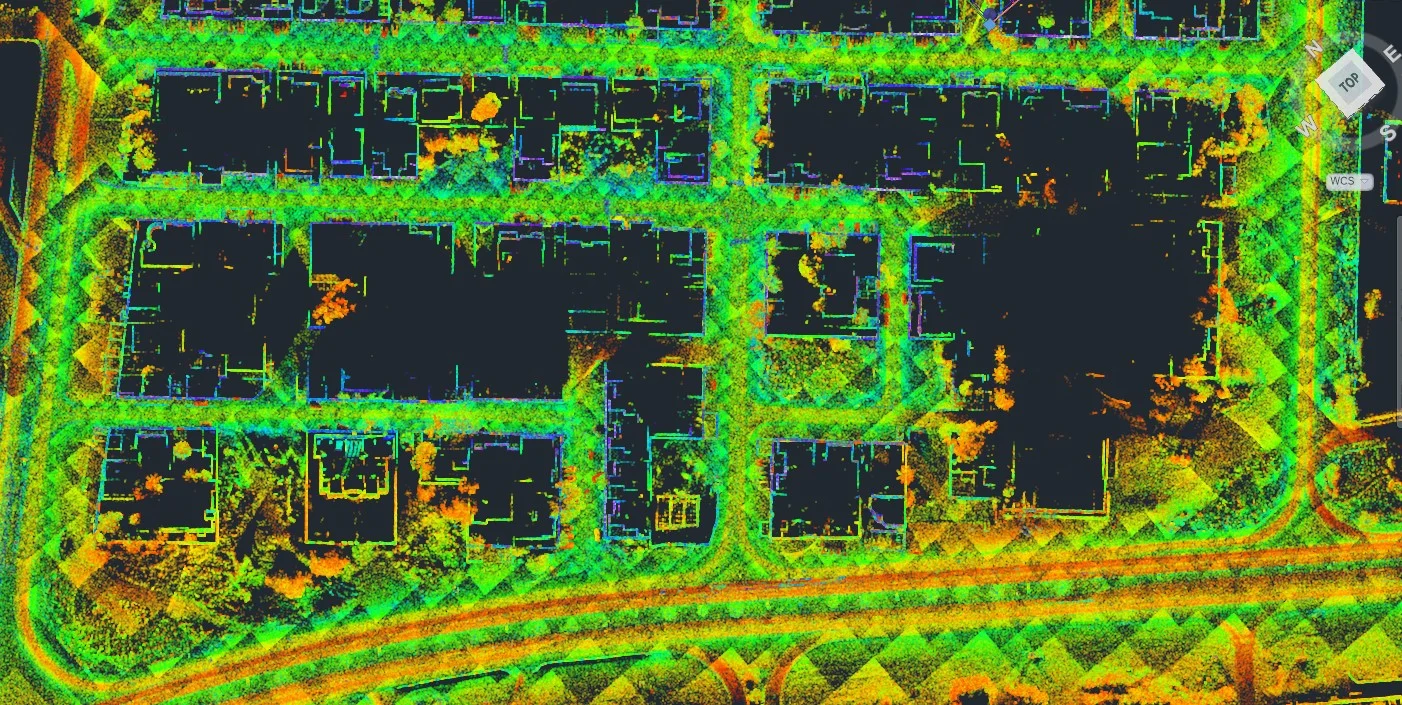
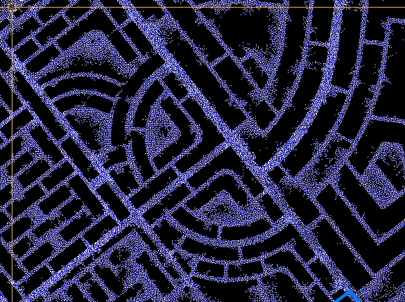
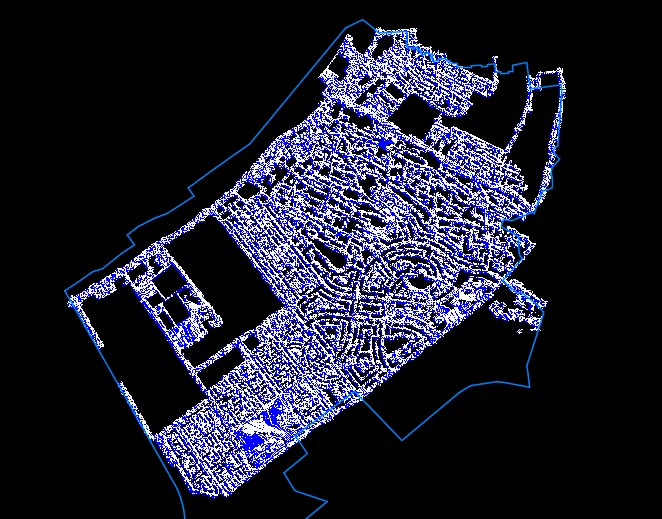
Smart City & Digital Twin Data
3D urban datasets for municipality GIS and digital twin platforms
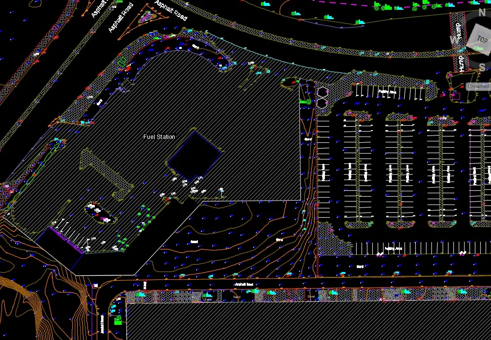
Deliverables
What you receive at the end of every project
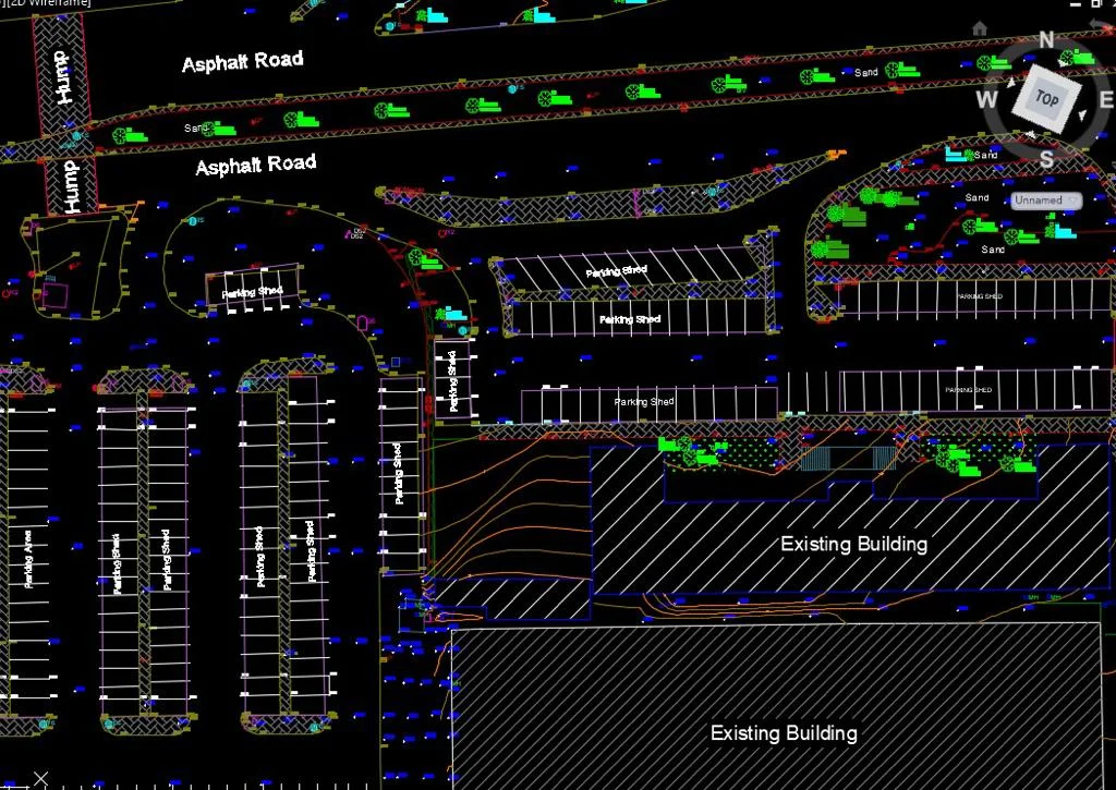
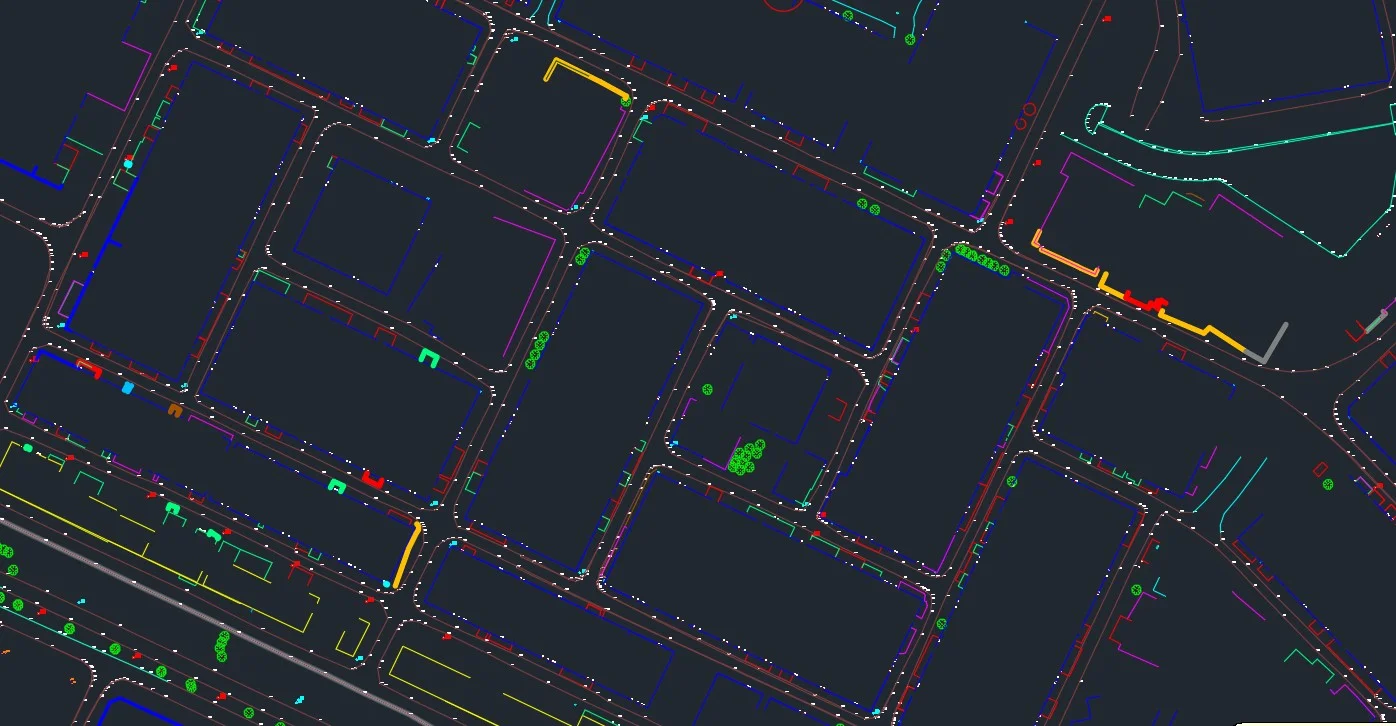
- Georeferenced point cloudLAS / LAZ — road corridor and surroundings
- Road cross-sections at required intervalsDWG / DXF
- Digital Terrain ModelPavement surface and road corridor
- Asset inventory with coordinatesSigns, markings, furniture — GIS-ready
- Survey accuracy report


Technology Stack
Industry-leading equipment and software
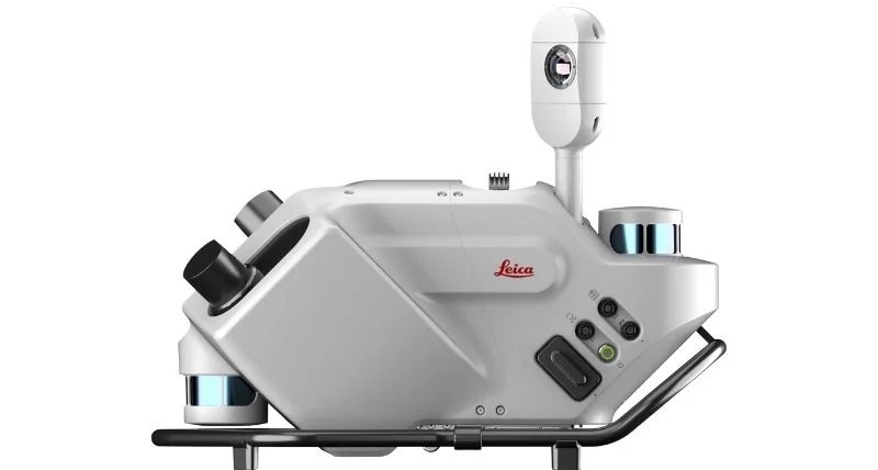
Leica Pegasus Two
Advanced surveying technology for precision data capture and analysis.
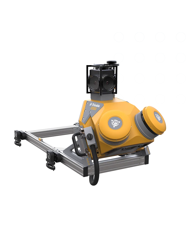
Trimble MX50 Mobile Mapper
Advanced surveying technology for precision data capture and analysis.
TerraScan
Advanced surveying technology for precision data capture and analysis.
Frequently Asked Questions
Mobile LiDAR maps road corridors from ground level at driving speeds, capturing road surfaces, drainage, signs, and structures in high detail. Drone survey covers large areas from the air, capturing the top surface. For road surveys, mobile LiDAR provides superior detail of road-level features; for large-area terrain, drones are faster.
With proper GNSS base stations and IMU correction, mobile LiDAR achieves ±30–50 mm absolute accuracy for point positions. For cross-section extraction and road level surveys, this is comparable to traditional total station surveys but at 100× the speed.
Yes. Mobile LiDAR surveys are designed to operate on live roads without closures. The system captures data at normal traffic speeds. Some passes in opposite directions are needed for complete coverage.
Have more questions?
Our team of experts is ready to assist you with your specific project requirements across the GCC.
Related Services
Explore our other professional surveying solutions
Aerial Drone Mapping
High-resolution aerial data acquisition for terrain modeling, volumetric analysis, and site documentation.
GIS & Geospatial Solutions
Structured geospatial data management, mapping, and spatial analysis services for infrastructure and asset systems.
Land Survey Dubai
Professional land survey services in Dubai for construction, development, and infrastructure projects. Authority-approved, ISO-certified, 25+ years experience.
Contact us directly
Reach our team instantly via WhatsApp, phone, or email.
Also available in Riyadh