You can't upgrade what you've never measured. Al Warqa captured 1,400 km of UAE city infrastructure in 20 days using the Trimble MX50 — giving planners a survey-grade digital record before a single upgrade begins.
Every road widening, utility upgrade and corridor redesign starts from the same place: a record of what's already there. For most cities, that record has never been complete. Mobile mapping changes where the work begins.
Cities have always been upgraded half-blind
For decades, the plans behind an infrastructure upgrade rested on whatever record happened to exist — drawings from the original build, partial as-builts, utility maps that were never reconciled, and a great deal of local memory. Accurate enough to start. Rarely accurate enough to finish.
So every project absorbed the same hidden tax: redesigns when the ground didn't match the plan, clashes with services nobody had mapped, and survey crews sent back out, lane by lane, to fill the gaps. The data to do it properly existed in theory. Capturing it across a whole city, to survey grade, was simply too slow and too expensive to be worth it. So it didn't get done.
Mobile mapping doesn't make the old survey faster. It makes a city-scale survey possible at all.
What changed: survey at traffic speed
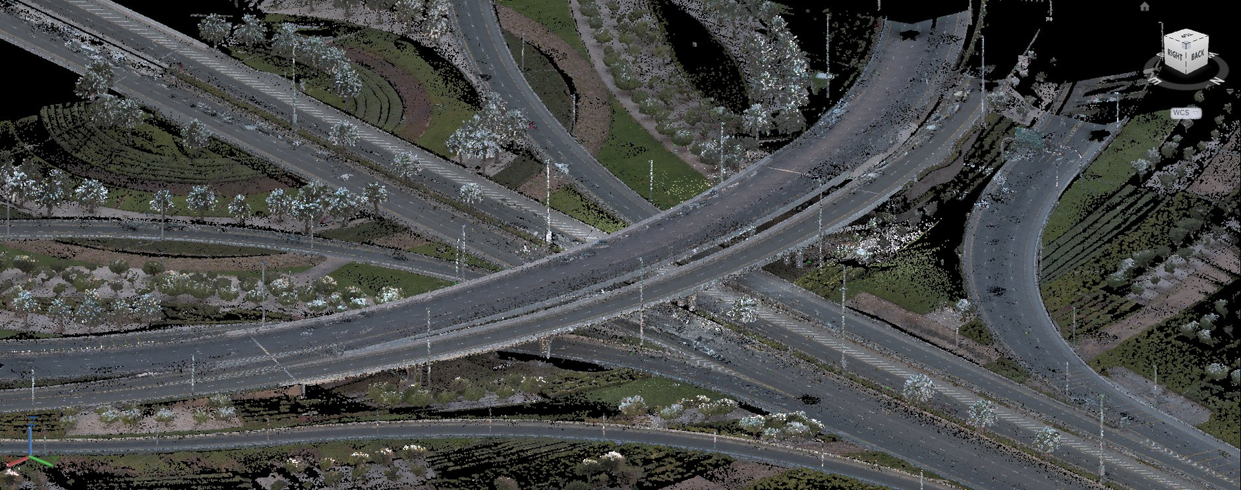
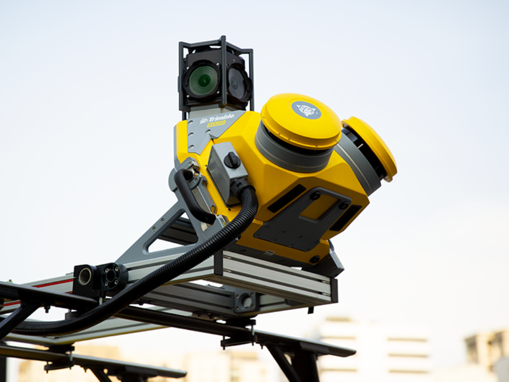
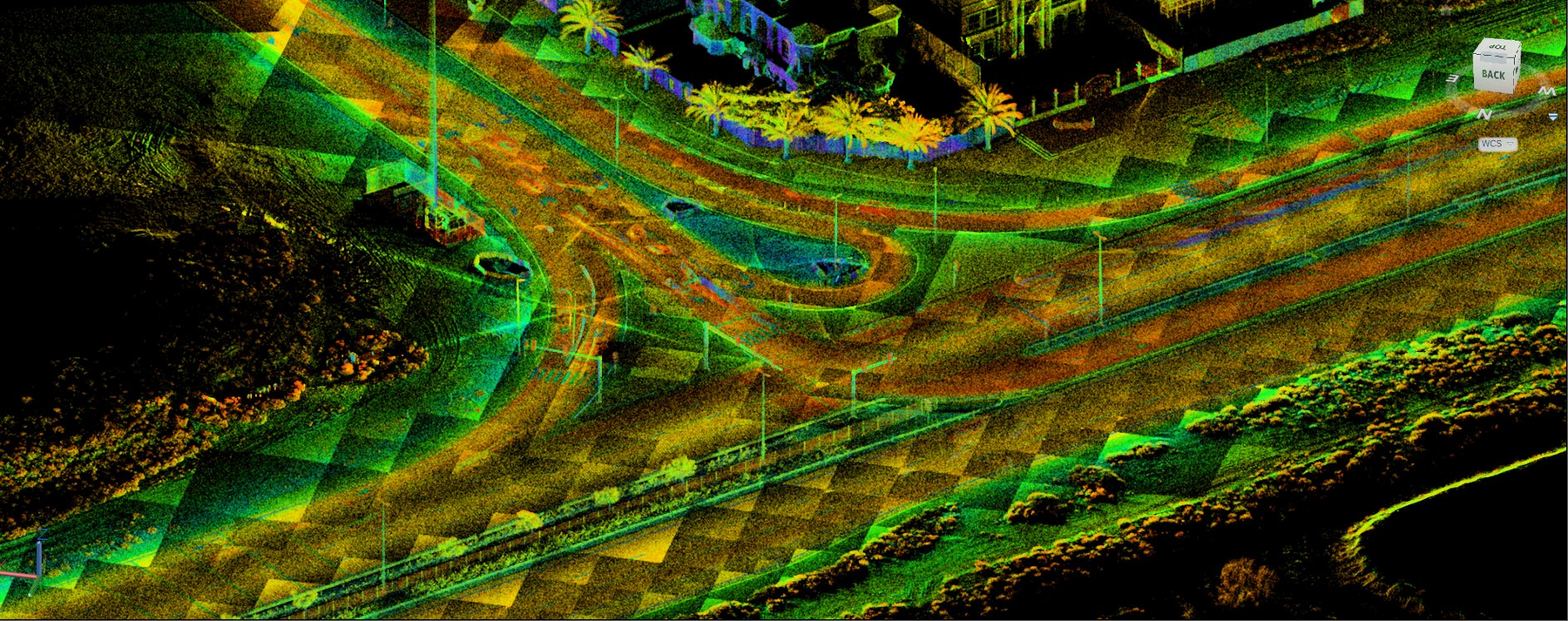
At Al Warqa Survey Engineering, we map at traffic speed. A vehicle-mounted Trimble MX50 drives the network and captures everything around it — road surface, kerbs, signage, lighting, utilities, structures — as a survey-grade 3D point cloud, paired with 360° imagery tied to real-world coordinates.
No lane closures. No crews standing in live traffic. No years of fieldwork. A whole city's corridors become a single, accurate, revisitable digital record — the baseline every upgrade should have started from all along.
On the ground: 1,400 km of city, measured
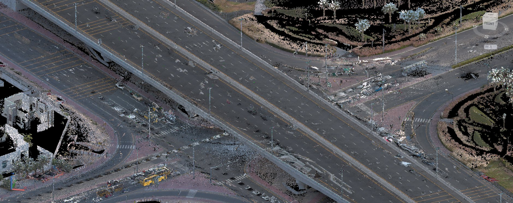
On a recent UAE programme, we captured 1,400 kilometres of diverse infrastructure — from mountain corridors to dense urban lanes — with field capture completed in just 20 days and full turnaround to delivered data in 45 days. The same scope, surveyed conventionally, would have meant months of crews on live roads, with closures and traffic management at every stretch. The authority received a complete, survey-grade digital record of the network, ready to plan upgrades from.
- 1,400 km of network captured across diverse terrain
- 20 days of field capture — no lane closures, no traffic disruption
- 45 days to full data delivery
- Less than 5 cm survey-grade accuracy throughout
What a measured city makes possible
Once the baseline exists, the upgrade work changes character. Planners stop guessing and start designing from reality:
- Road and corridor upgrades — design widenings and realignments against the real surface and kerb lines, not an old drawing
- Utility and asset management — a complete inventory of what's there and where, ready for GIS
- Remote inspection — revisit any junction or asset from the desk, without sending anyone back to site
- Digital twin foundation — a living 3D record the city keeps, updates, and builds on
The corridor isn't surveyed once for one project and forgotten. It becomes an asset the city owns — and every future upgrade starts a step ahead.
Where infrastructure work begins now
The old order was: decide the upgrade, then send crews to measure what you could afford to. The data shaped itself around the budget, and the gaps showed up on site.
The new order is the other way around. Measure the city first — fully, accurately, once — and let every upgrade be designed against the truth. It's the difference between modernising a city and patching it.
Al Warqa Survey Engineering deploys the Trimble MX50 across the UAE and KSA for road corridor surveys, infrastructure baseline mapping, and digital twin programmes. Contact us to scope your network.
Frequently Asked Questions
What is mobile mapping in surveying?
Mobile mapping is a method of collecting geospatial data from a moving vehicle. A system like the Trimble MX50 combines LiDAR scanners, cameras, GPS, and an IMU to capture a survey-grade 3D point cloud and 360° imagery of everything along the route — at normal driving speed, with no need to stop or close lanes.
How accurate is mobile LiDAR mapping?
Survey-grade mobile mapping systems achieve better than 5 cm absolute accuracy when tied to ground control points. The Trimble MX50 delivers this level across long road networks, making the data suitable for engineering design, asset management, and authority submissions.
How long does it take to map a city road network?
On our recent UAE programme, we captured 1,400 km of road network in 20 days of field work, with processed and delivered data completed within 45 days. Conventional survey methods for the same scope would have taken months and required significant traffic management.
What deliverables does mobile mapping produce?
A mobile mapping survey typically delivers a survey-grade 3D point cloud, 360° geo-referenced imagery, CAD linework (road edges, kerbs, lane markings, signage), GIS-ready asset data, and — where required — a digital twin foundation model. All data is tied to real-world survey control.
Need a Survey in Dubai?
Al Warqa Survey Engineering — ISO 9001:2015 certified, operating since 2000. 15,000+ projects completed across the UAE and KSA.
Get a Free Quote