3D Laser Scanning Riyadh
Professional 3D laser scanning services in Riyadh and across Saudi Arabia. Terrestrial LiDAR, point cloud data capture, and Scan-to-BIM for NEOM, Vision 2030, and industrial projects.
3D Laser Scanning Services in Riyadh & KSA
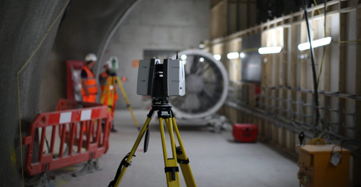
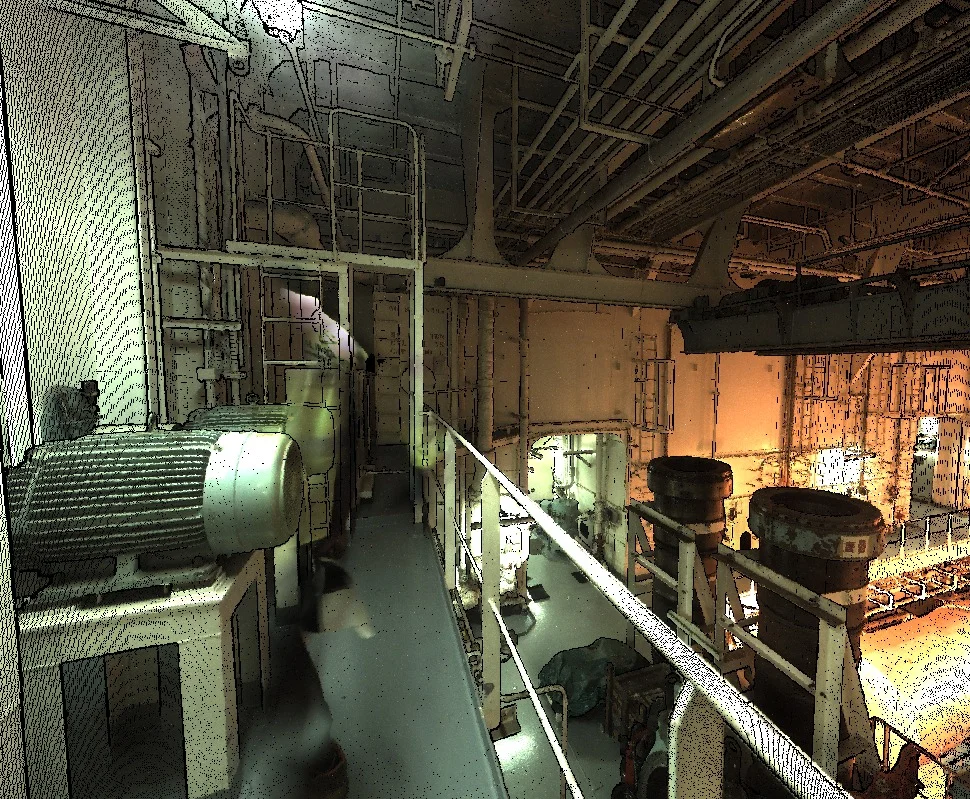
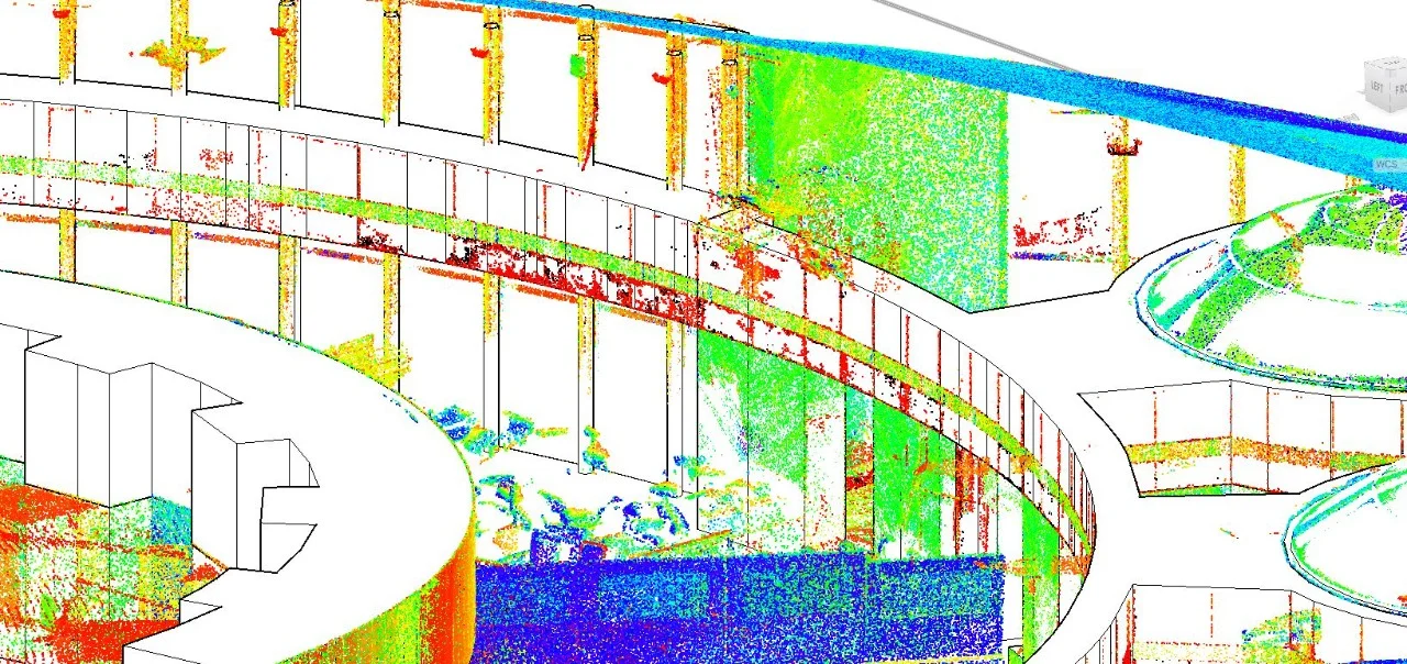
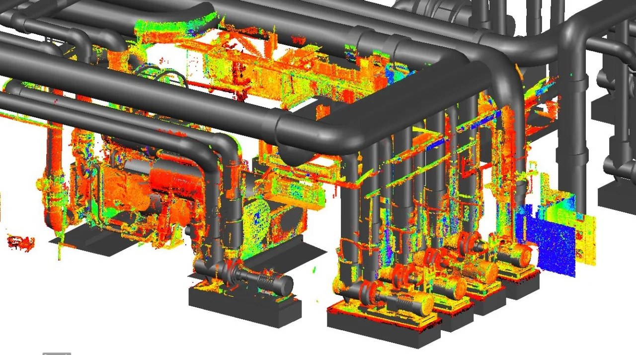
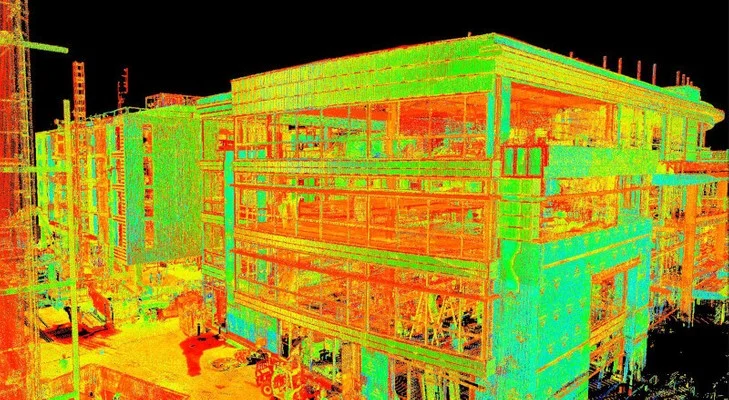
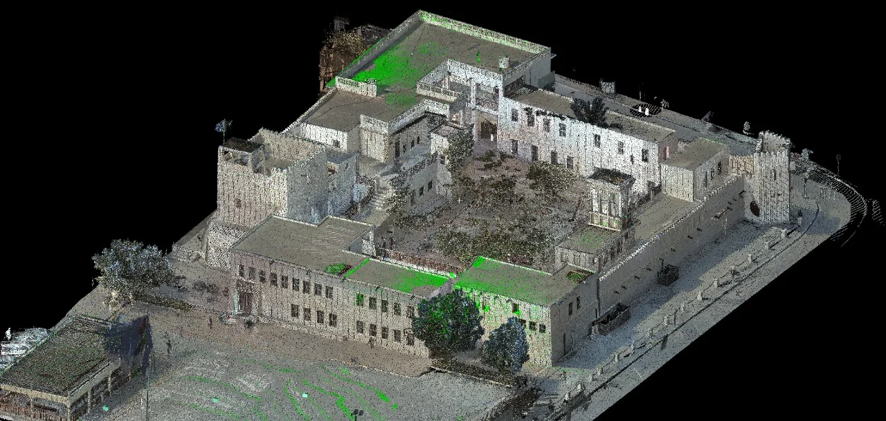
Al Warqa Survey Engineering provides terrestrial 3D laser scanning services in Riyadh, Jeddah, and across Saudi Arabia. We deploy Leica RTC360 and Trimble X7 scanners to capture high-density point clouds of buildings, industrial plants, infrastructure, and heritage assets — delivering millimetre-accurate 3D datasets for design, documentation, and BIM workflows.
Saudi Arabia's Vision 2030 and NEOM mega-projects require detailed as-built documentation and BIM models. Our Riyadh-accessible laser scanning teams deliver rapid point cloud capture and Scan-to-BIM services to the Saudi National Coordinate System (SNCS) and project-specific requirements.
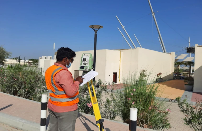
Our Methodology
Delivering excellence through a proven three-stage workflow
Scan Planning & Setup
Plan scanner positions for full coverage with adequate overlap. Set up targets for scan registration to SNCS or project coordinate system.
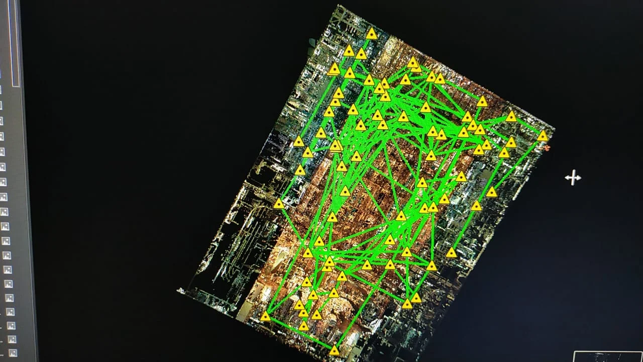
Data Capture & Registration
Execute systematic scanning with Leica RTC360 or Trimble X7. Register scans in Cyclone REGISTER 360 to achieve <3mm RMS accuracy.
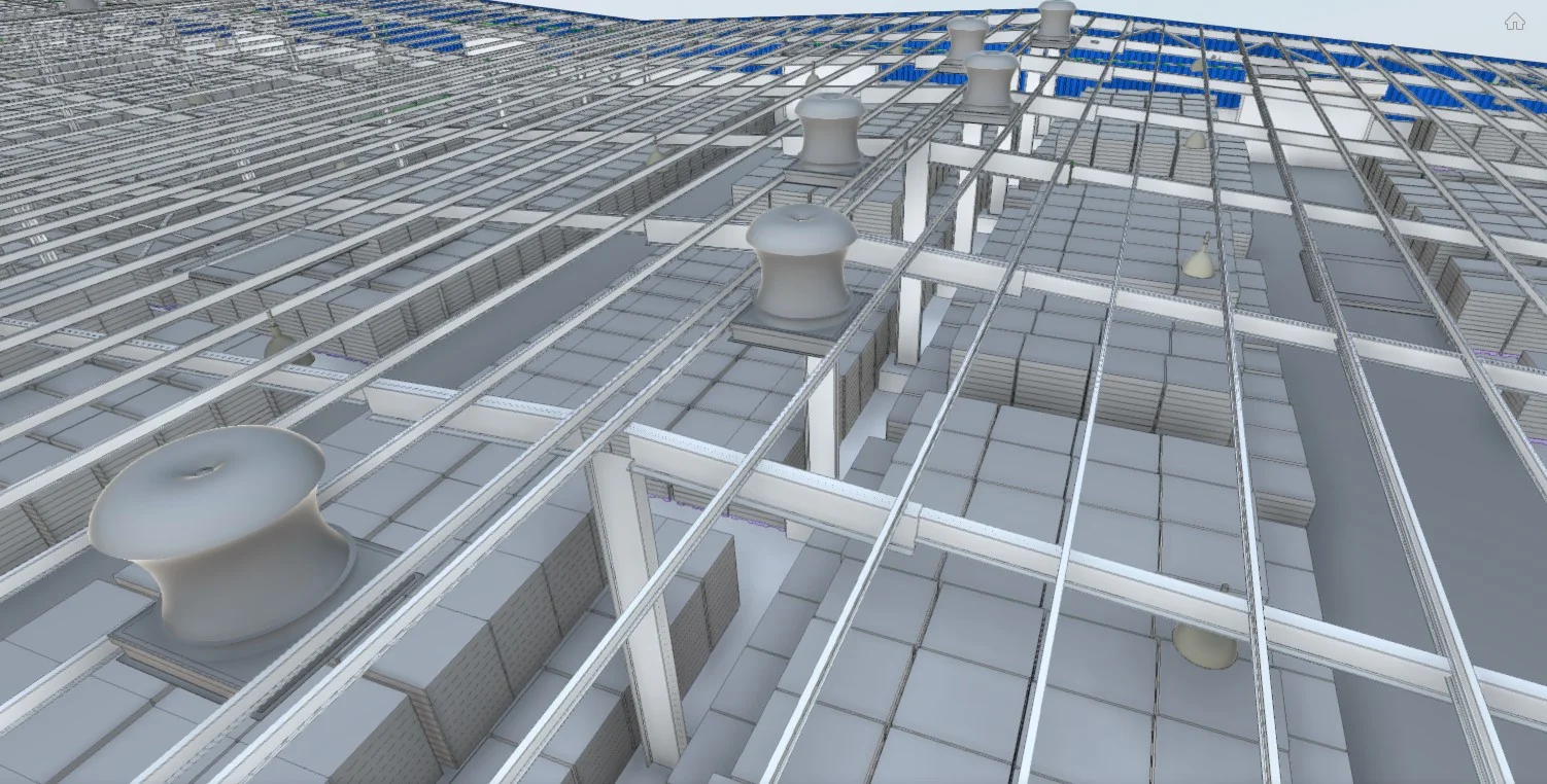
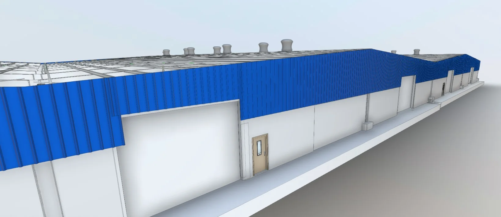
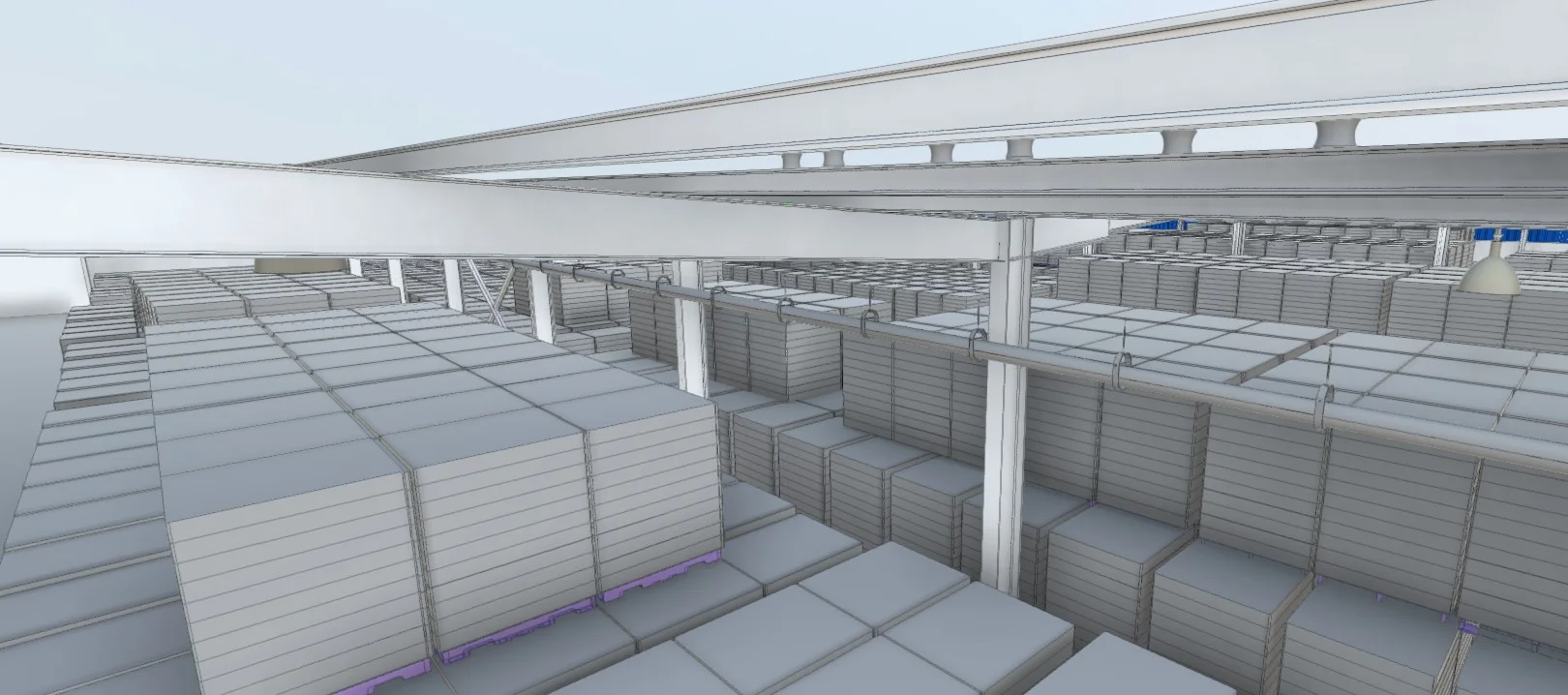
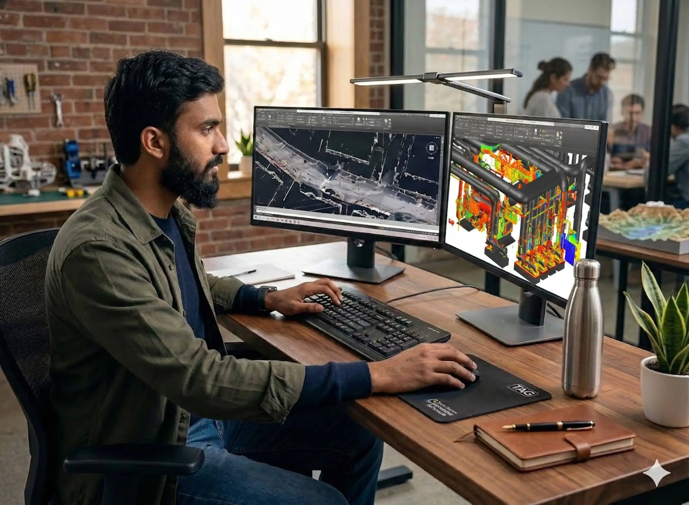
Processing & BIM Delivery
Clean and deliver point cloud in E57/RCP; model Scan-to-BIM in Revit if required. Produce drawings and reports to project specification.
Applications
Industry sectors and use cases we serve
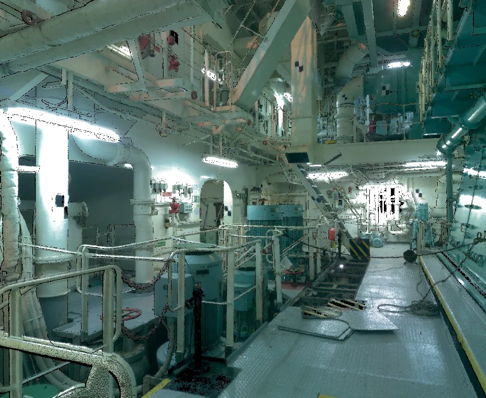
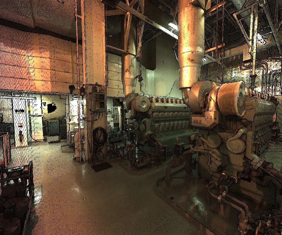
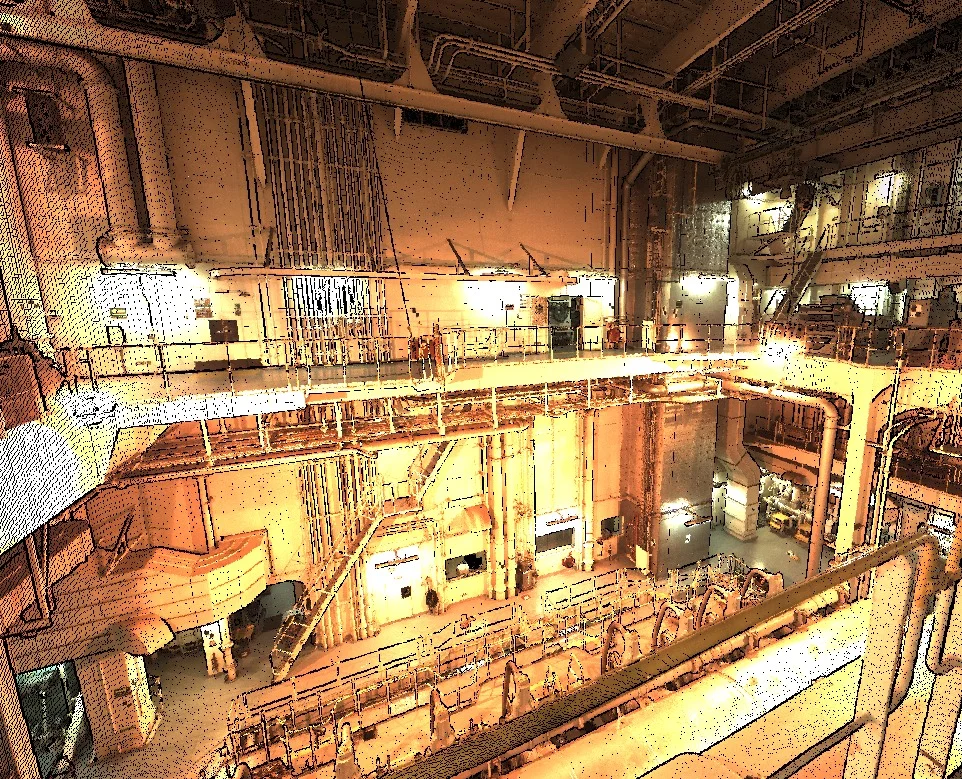
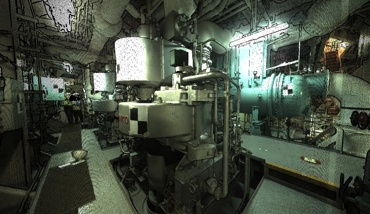
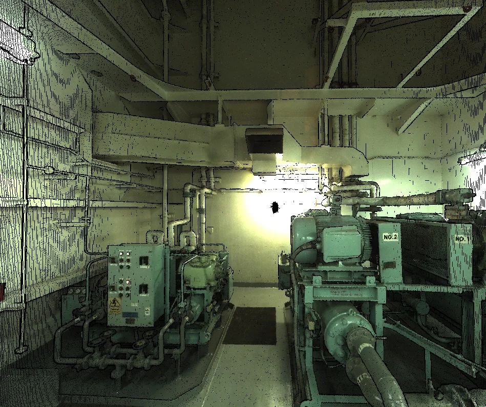
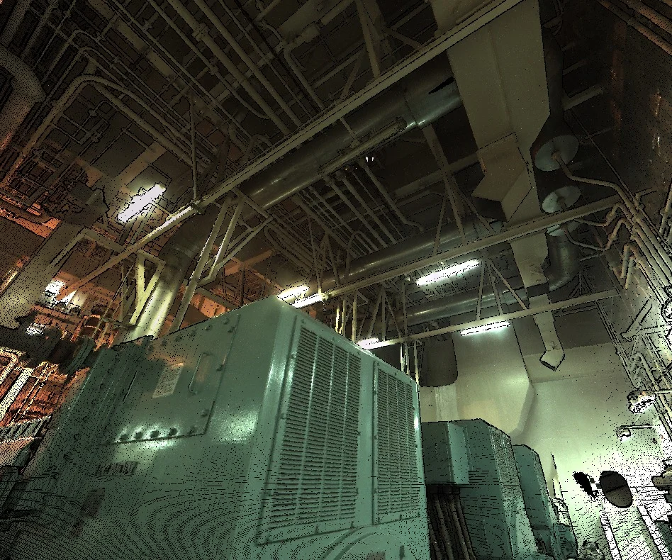
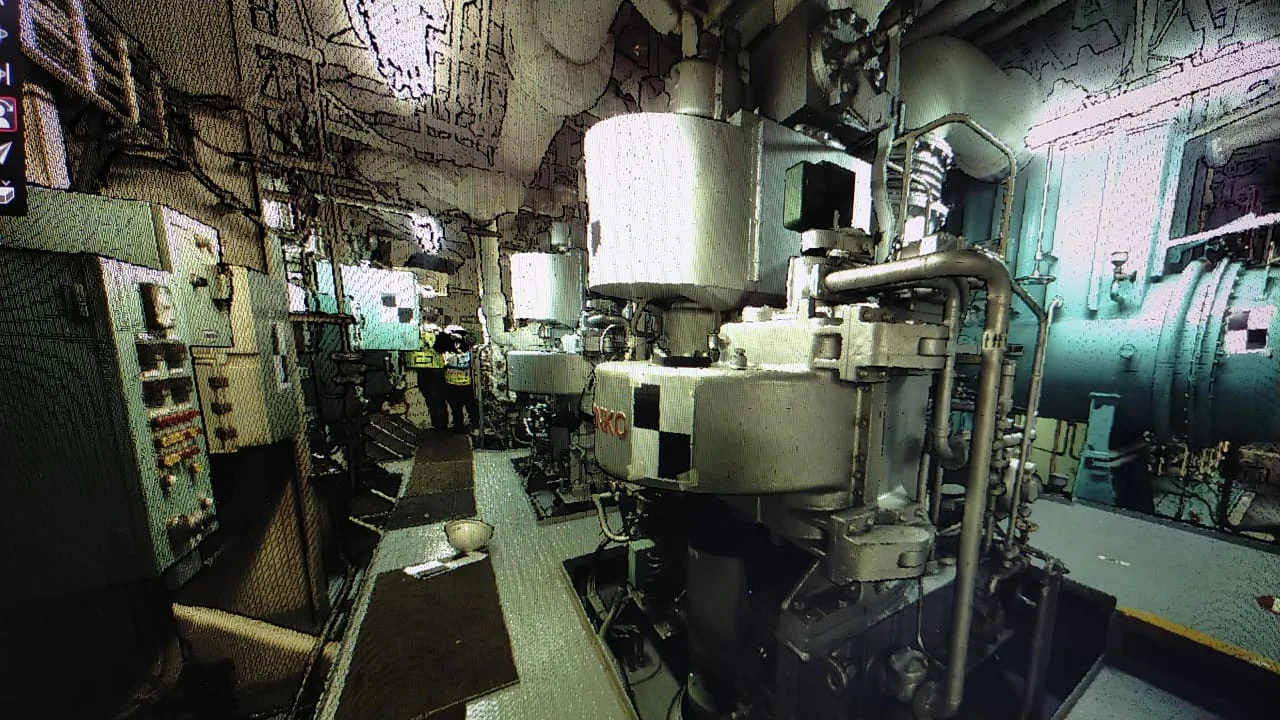
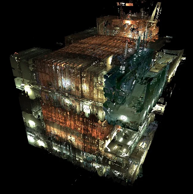
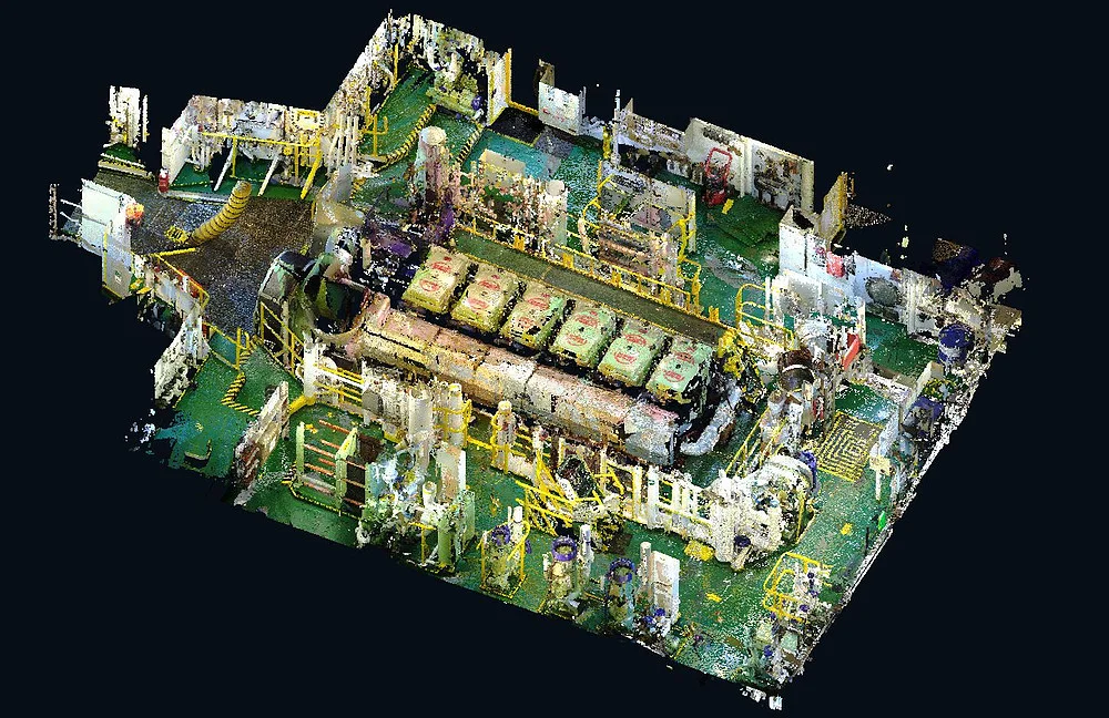
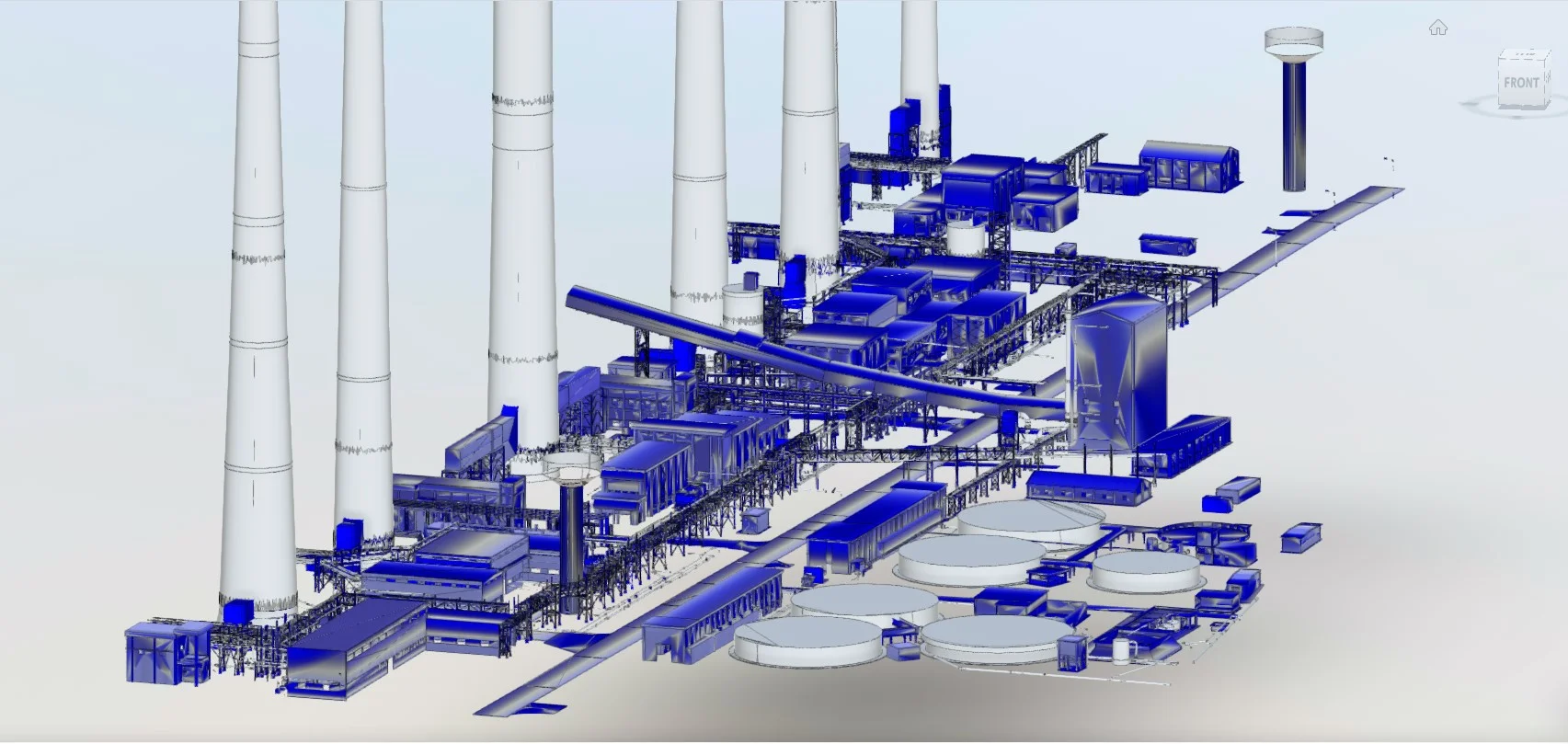
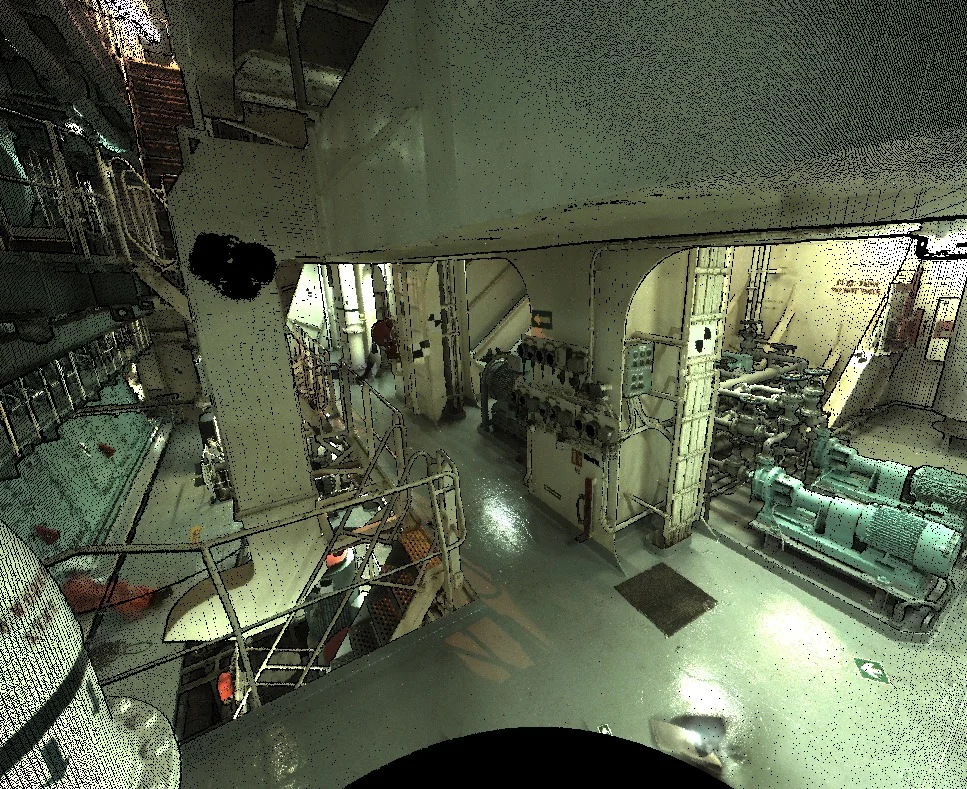
Industrial Plant As-Built Documentation
Petrochemical, refinery, and industrial facility 3D surveys for SABIC, Aramco, and contractors
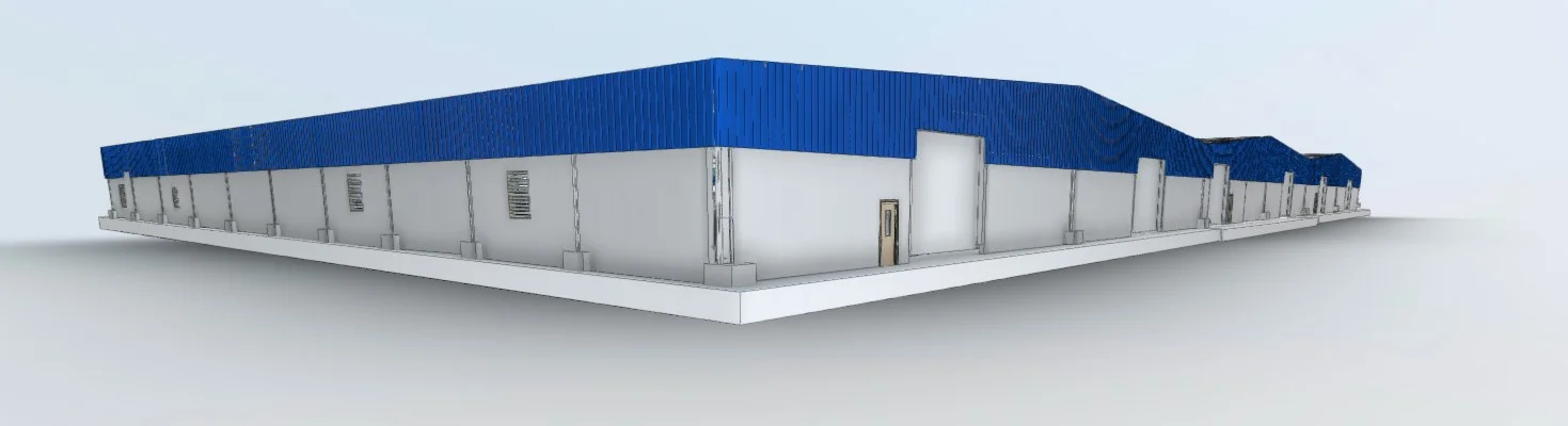
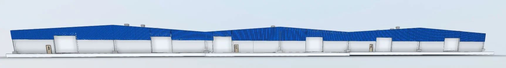
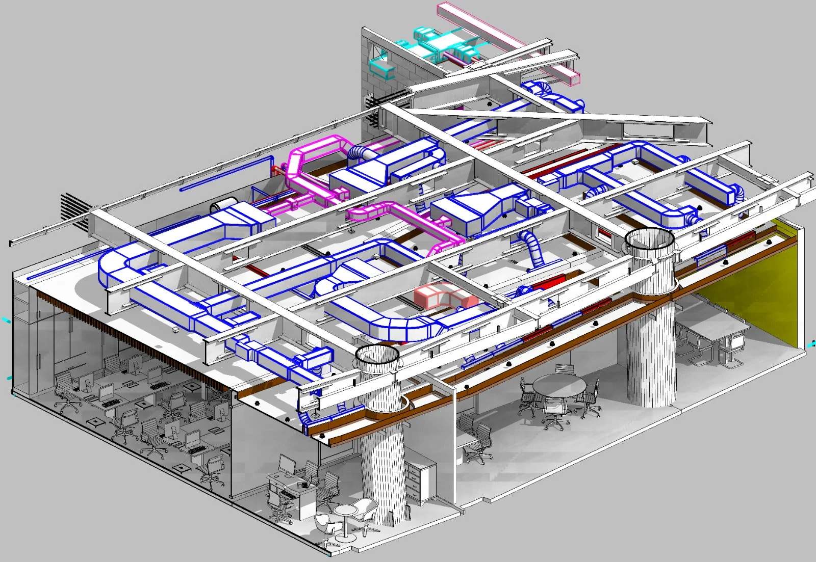
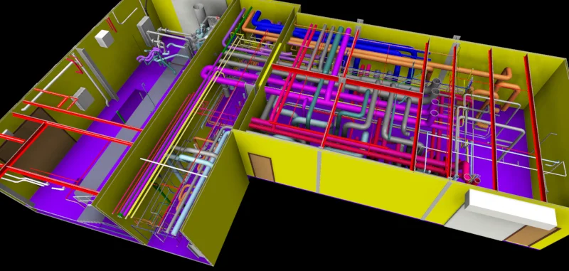
Scan-to-BIM for Renovation
Heritage, hotel, and commercial building BIM models from laser scan data
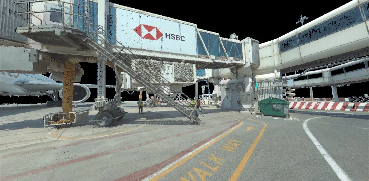
NEOM & Mega-Project Surveys
Large-scale interior and façade scanning for Vision 2030 infrastructure
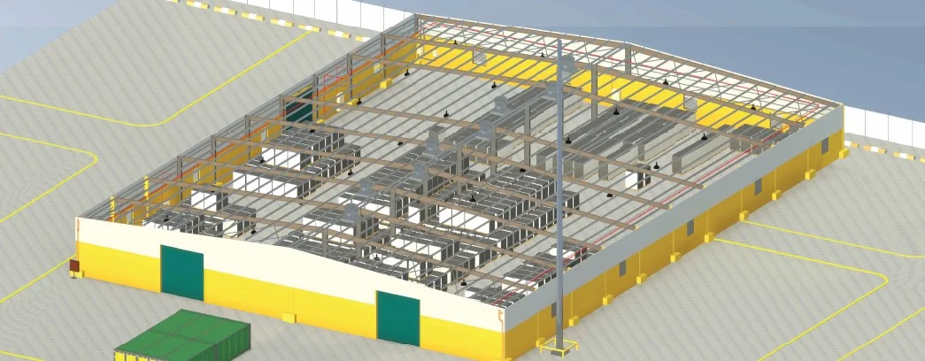
Structural & MEP Documentation
Detailed point clouds for clash detection and construction verification
Deliverables
What you receive at the end of every project
- Registered point cloudE57 / RCP — SNCS coordinate system
- Scan-to-BIM modelRevit RVT to required LOD
- As-built 2D drawings from scanDWG / DXF
- Point cloud accuracy report
- Rendered 3D viewsPDF / PNG


Technology Stack
Industry-leading equipment and software
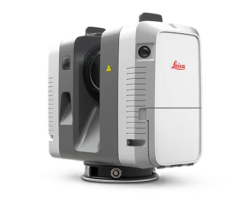
Leica RTC360
Advanced surveying technology for precision data capture and analysis.
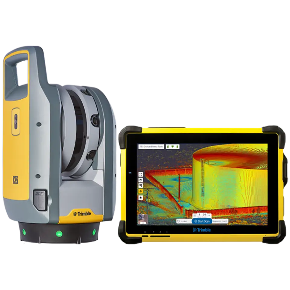
Trimble X7
Advanced surveying technology for precision data capture and analysis.
Cyclone REGISTER 360
Advanced surveying technology for precision data capture and analysis.
Frequently Asked Questions
Yes. Al Warqa Survey Engineering operates from our Riyadh office with scanning equipment permanently based in KSA, avoiding mobilisation delays and additional costs.
Leica RTC360 achieves ±1.9mm range accuracy at 10m. Registered scan projects typically achieve 3–5mm overall accuracy, suitable for as-built documentation, Scan-to-BIM, and clash detection.
Yes. Our BIM team models scan data in Autodesk Revit to any required LOD (100–500) for renovation, facility management, and design coordination.
We serve oil & gas (Aramco, SABIC), construction (NEOM, Diriyah), hospitality, government, and infrastructure sectors across the Kingdom.
Have more questions?
Our team of experts is ready to assist you with your specific project requirements across the GCC.
Related Services
Explore our other professional surveying solutions
3D Laser Scanning
High-precision terrestrial laser scanning for detailed 3D capture of buildings, structures, and industrial environments.
BIM Modeling Dubai
Professional BIM modeling services in Dubai and the UAE. Scan-to-BIM, Revit modeling, and LOD 100–500 models from point cloud and survey data for construction, renovation, and facility management projects.
Survey Company Riyadh
Al Warqa Survey Engineering — a professional survey company in Riyadh with a permanent KSA office. Land, drone, 3D laser scanning, GIS, and BIM survey services for Saudi projects.
Contact us directly
Reach our team instantly via WhatsApp, phone, or email.
Also available in Riyadh