Hydrographic Survey In Dubai
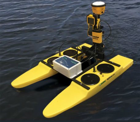
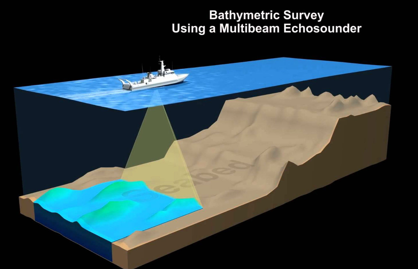
HYDROGRAPHIC SURVEY are made to acquire data required to chart and/or map shorelines and bottom depths of streams, rivers, lakes, reservoirs and other larger bodies of water. This type of survey is also of general importance to navigation and to development of water resources for flood control, irrigation, electrical power, and water supply. As in other special surveys, several different types of electronic and radio-acoustical instruments are used in hydrographic surveys.These special devices are commonly used in determining water depths and location of objects on the bottom by a method called taking SOUNDING. Sounding are taken by measuring the time required for sound to travel downward and be reflected back to a receiver aboard a vessel
Most surveys are primarily concerned with water depth.The nature of the sea floor material because of the implications for anchoring, dredging, structure construction, pipeline and cable routing and fisheries habitat.SONAR (SOund NAvigation and Ranging) uses sound waves to find and identify objects in the water and to determine water depth.The data is collected and processed digitally with specialized computer systems that store the data in digital form.